MyTopo
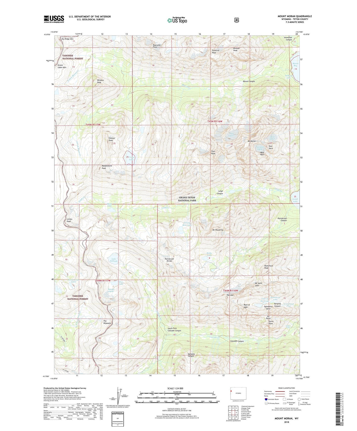
Mount Moran Wyoming US Topo Map
Couldn't load pickup availability
Also explore the Mount Moran Forest Service Topo of this same quad for updated USFS data
2021 topographic map quadrangle Mount Moran in the state of Wyoming. Scale: 1:24000. Based on the newly updated USGS 7.5' US Topo map series, this map is in the following counties: Teton. The map contains contour data, water features, and other items you are used to seeing on USGS maps, but also has updated roads and other features. This is the next generation of topographic maps. Printed on high-quality waterproof paper with UV fade-resistant inks.
Quads adjacent to this one:
West: Granite Basin
Northwest: Rammell Mountain
North: Ranger Peak
Northeast: Colter Bay
East: Jenny Lake
Southeast: Moose
South: Grand Teton
Southwest: Mount Bannon
This map covers the same area as the classic USGS quad with code o43110g7.
Contains the following named places: Arrowhead Pool, Bivouac Peak, Cascade Canyon, Cascade Canyon Trail, Cascade Ranger Station, Cirque Lake, Cleaver Peak, Dry Ridge Mountain, East Horn, Falling Ice Glacier, Grizzly Bear Lake, Hidden Falls, Holly Lake, Ice Point, Lake of the Crags, Lake Solitude, Lake Solitude Trail, Leigh Canyon, Leigh Creek, Littles Peak, Maidenform Peak, Mica Lake, Mink Lake, Moran Canyon, Moran Creek, Moran Lake, Mount Moran, Mount Saint John, Mount Woodring, North Fork Moran Creek, Ortenburger Lake, Paintbrush Canyon, Paintbrush Divide, Paintbrush Divide Trail, Petersen Glacier, Ramshead Lake, Ramshield Lake, Raynolds Peak, Rock of Ages, Rockchuck Peak, Skillet Glacier, South Fork Cascade Canyon, South Fork Moran Creek, Storm Point, Symmetry Spire, The Jaw, The Wigwams, Thor Peak, Traverse Peak, Triple Glaciers, Valhalla Canyon, West Horn, Window Peak