MyTopo
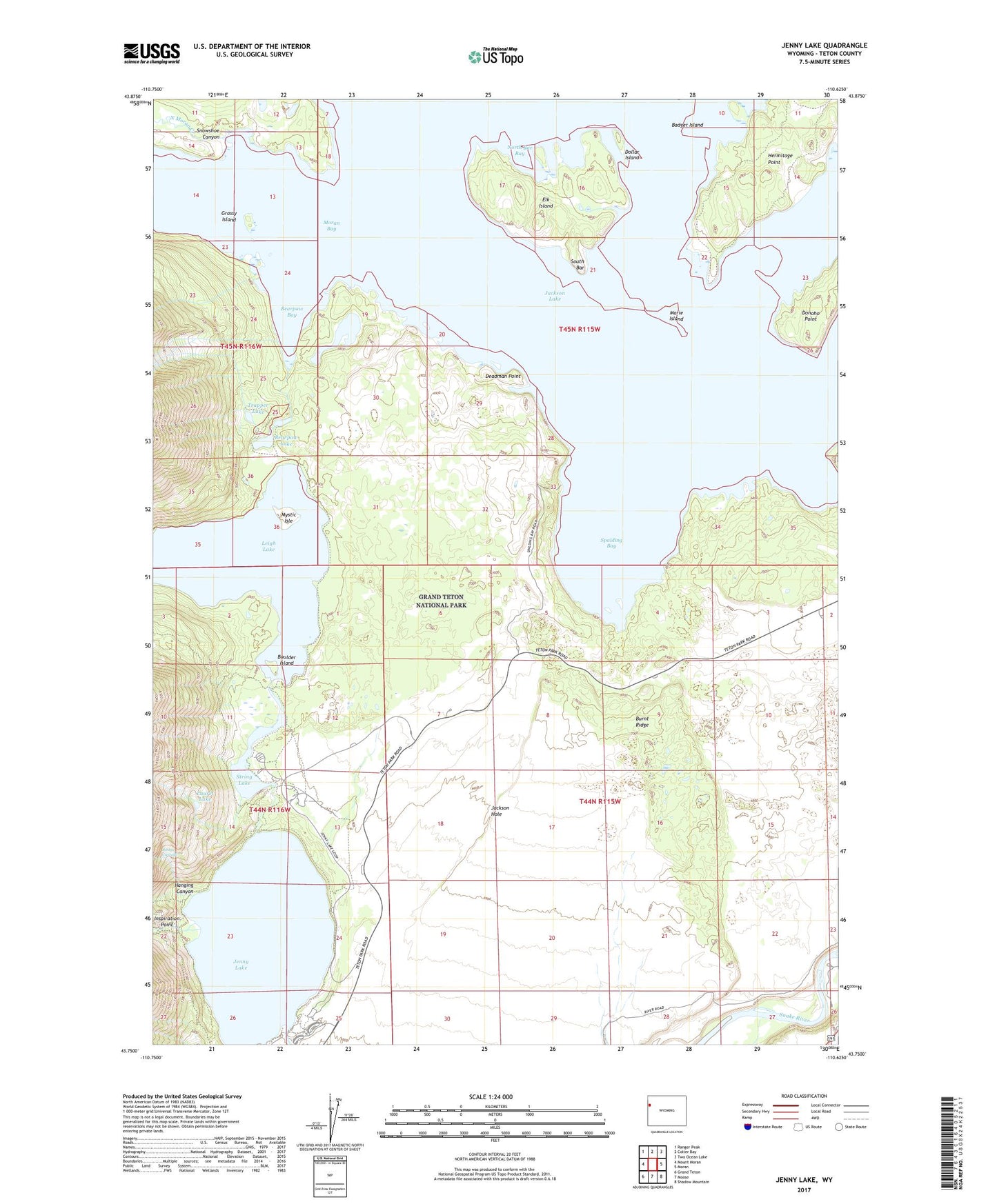
Jenny Lake Wyoming US Topo Map
Couldn't load pickup availability
Also explore the Jenny Lake Forest Service Topo of this same quad for updated USFS data
2021 topographic map quadrangle Jenny Lake in the state of Wyoming. Scale: 1:24000. Based on the newly updated USGS 7.5' US Topo map series, this map is in the following counties: Teton. The map contains contour data, water features, and other items you are used to seeing on USGS maps, but also has updated roads and other features. This is the next generation of topographic maps. Printed on high-quality waterproof paper with UV fade-resistant inks.
Quads adjacent to this one:
West: Mount Moran
Northwest: Ranger Peak
North: Colter Bay
Northeast: Two Ocean Lake
East: Moran
Southeast: Shadow Mountain
South: Moose
Southwest: Grand Teton
This map covers the same area as the classic USGS quad with code o43110g6.
Contains the following named places: Badger Island, Bearpaw Bay, Bearpaw Lake, Boulder Island, Burnt Ridge, Cascade Creek, Cathedral Group Scenic Turnout, Deadman Point, Dollar Island, Donoho Point, Elk Island, Grand Teton National Park, Grassy Island, Hanging Canyon, Hermitage Point, Hidden Falls Horse Trail, Inspiration Point, Jenny Lake, Jenny Lake Campground, Jenny Lake Lodge, Jenny Lake Moraine Horse Trail, Jenny Lake Post Office, Jenny Lake Trail, Laurel Lake, Leigh Lake, Marie Island, Moran Bay, Mount Moran Scenic Turnout, Mystic Isle, North Bar Bay, North Jenny Lake Junction, North Moran Creek, Paintbrush Canyon Trail, Ribbon Cascade, Snowshoe Canyon, South Bar, Spalding Bay, String Lake, String Lake Trail, Trapper Lake