MyTopo
Corral Creek Wyoming US Topo Map
Couldn't load pickup availability
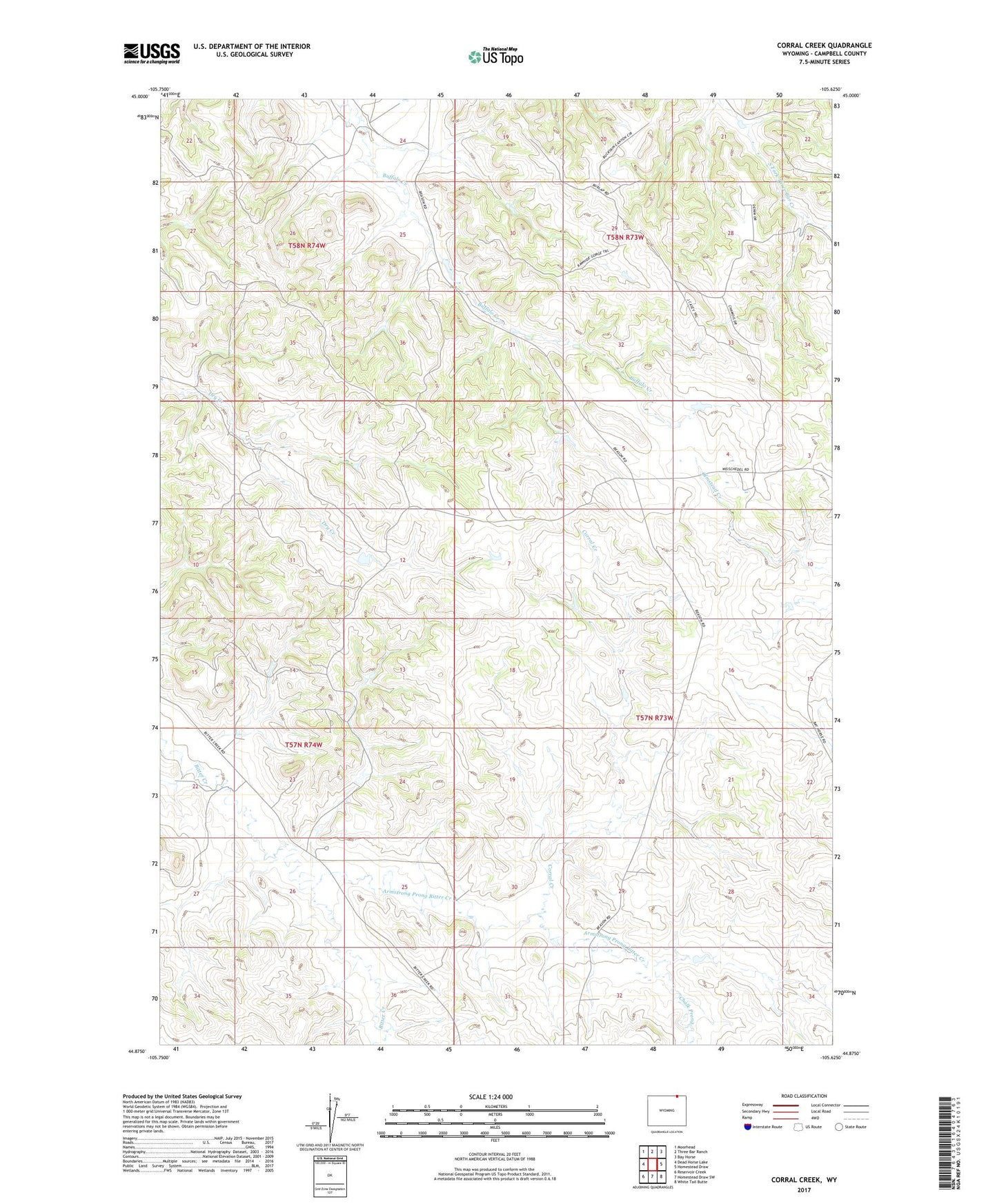
2021 topographic map quadrangle Corral Creek in the state of Wyoming. Scale: 1:24000. Based on the newly updated USGS 7.5' US Topo map series, this map is in the following counties: Campbell. The map contains contour data, water features, and other items you are used to seeing on USGS maps, but also has updated roads and other features. This is the next generation of topographic maps. Printed on high-quality waterproof paper with UV fade-resistant inks.
Quads adjacent to this one:
West: Dead Horse Lake
Northwest: Moorhead
North: Three Bar Ranch
Northeast: Bay Horse
East: Homestead Draw
Southeast: White Tail Butte
South: Homestead Draw SW
Southwest: Reservoir Creek
Contains the following named places: Armstrong Prong Bitter Creek, Chalk Prong Armstrong Prong Bitter Creek, Corral Creek, Eaton Dam, Eaton Reservoir, Fox Farm Dam, Fox Farm Reservoir, J D Dam, J D Reservoir, Quarter Circle Prong Bitter Creek, Sandbar West Oil Field, Sawmill Dam, Sawmill Reservoir, Three Fork Canyon Area Number Two Mine, ZIP Code: 82725