MyTopo
Bay Horse Montana US Topo Map
Couldn't load pickup availability
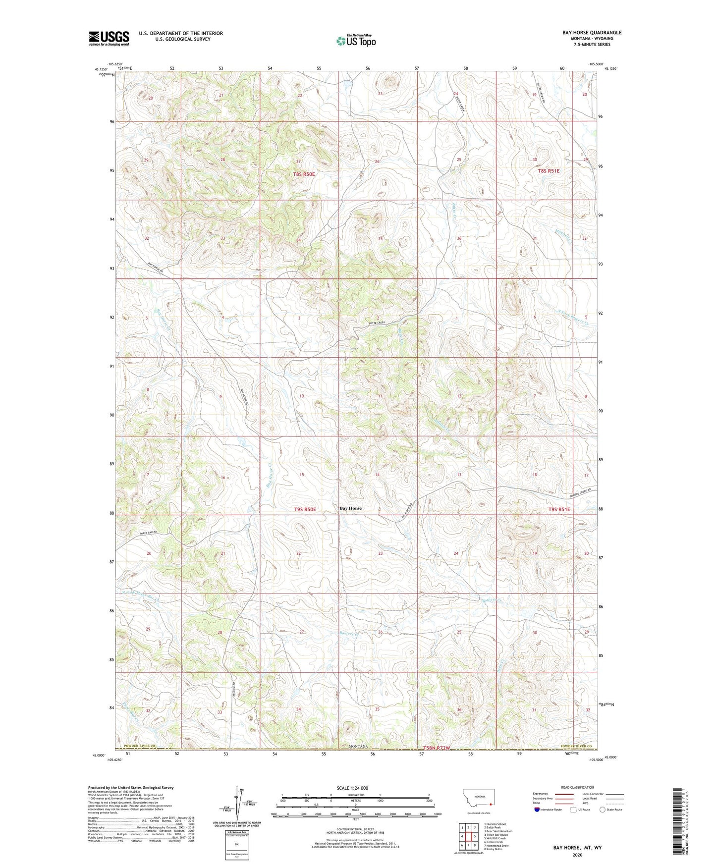
2024 topographic map quadrangle Bay Horse in the state of Montana. Scale: 1:24000. Based on the newly updated USGS 7.5' US Topo map series, this map is in the following counties: Powder River, Campbell. The map contains contour data, water features, and other items you are used to seeing on USGS maps, but also has updated roads and other features. This is the next generation of topographic maps. Printed on high-quality waterproof paper with UV fade-resistant inks.
Quads adjacent to this one:
West: Three Bar Ranch
Northwest: Huckins School
North: Baldy Peak
Northeast: Bear Skull Mountain
East: Wild Bill Creek
Southeast: Rocky Butte
South: Homestead Draw
Southwest: Corral Creek
Contains the following named places: 08S50E25CBDD01 Well, 08S50E36CA__01 Well, 09S51E30BDAA01 Well, Bay Horse, Deep Creek, Traubnumber 3 Dam