MyTopo
Homestead Draw Wyoming US Topo Map
Couldn't load pickup availability
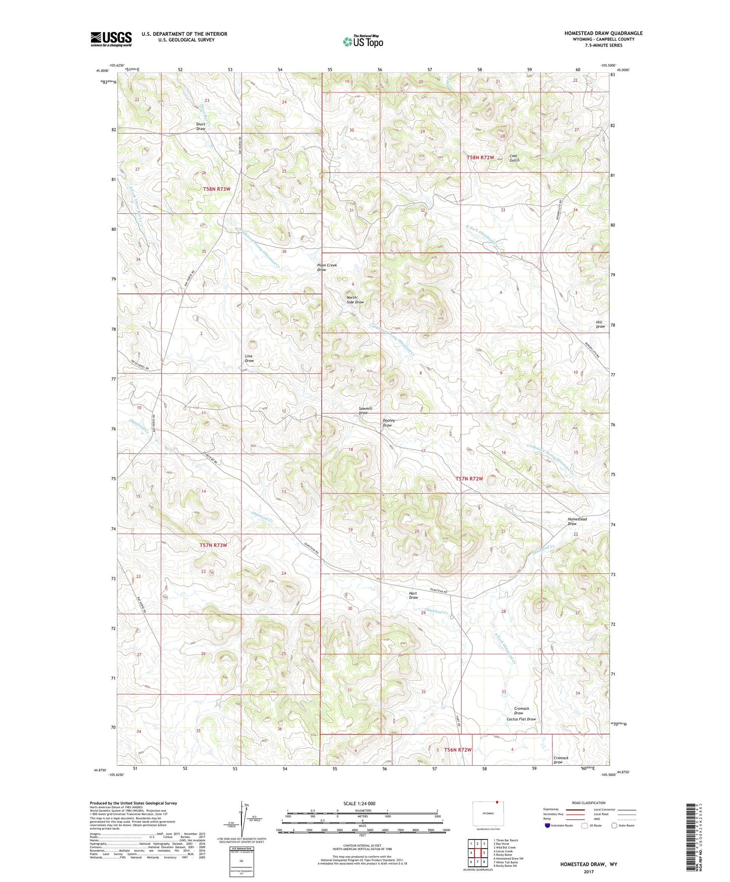
2021 topographic map quadrangle Homestead Draw in the state of Wyoming. Scale: 1:24000. Based on the newly updated USGS 7.5' US Topo map series, this map is in the following counties: Campbell. The map contains contour data, water features, and other items you are used to seeing on USGS maps, but also has updated roads and other features. This is the next generation of topographic maps. Printed on high-quality waterproof paper with UV fade-resistant inks.
Quads adjacent to this one:
West: Corral Creek
Northwest: Three Bar Ranch
North: Bay Horse
Northeast: Wild Bill Creek
East: Rocky Butte
Southeast: Rocky Butte SW
South: White Tail Butte
Southwest: Homestead Draw SW
This map covers the same area as the classic USGS quad with code o44105h5.
Contains the following named places: Cactus Flat Draw, Cookstove Prong Olmstead Creek, Cromack Draw, Dootey Draw, Hart Draw, Hill Draw, Homestead Draw, Line Draw, North Side Draw, Plum Creek Draw, Sawmill Draw, Short Draw, South Fork Olmstead Creek