MyTopo
Cottonwood Canyon Wyoming US Topo Map
Couldn't load pickup availability
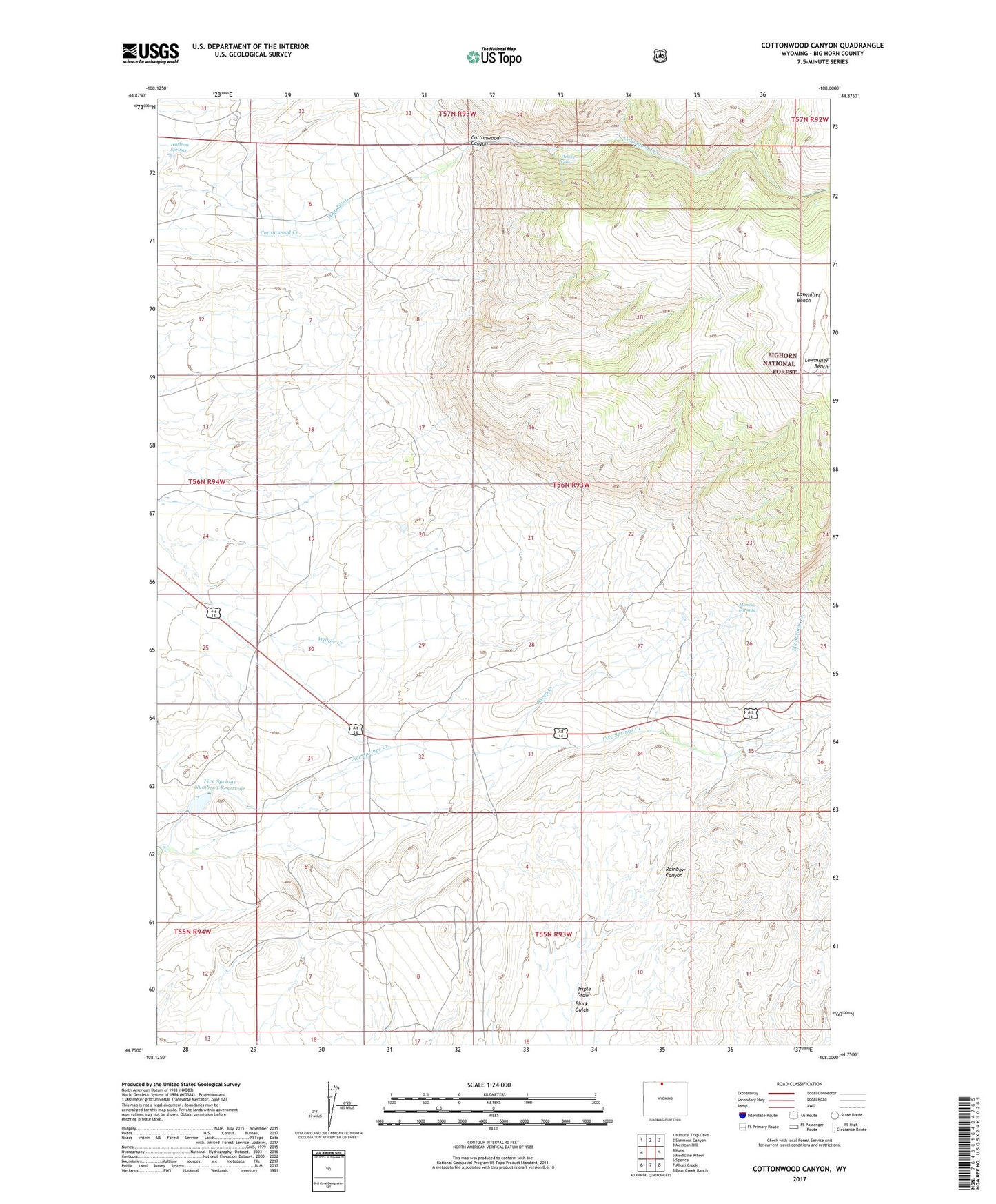
2021 topographic map quadrangle Cottonwood Canyon in the state of Wyoming. Scale: 1:24000. Based on the newly updated USGS 7.5' US Topo map series, this map is in the following counties: Big Horn. The map contains contour data, water features, and other items you are used to seeing on USGS maps, but also has updated roads and other features. This is the next generation of topographic maps. Printed on high-quality waterproof paper with UV fade-resistant inks.
Quads adjacent to this one:
West: Kane
Northwest: Natural Trap Cave
North: Simmons Canyon
Northeast: Mexican Hill
East: Medicine Wheel
Southeast: Bear Creek Ranch
South: Alkali Creek
Southwest: Spence
Contains the following named places: Cottonwood Canyon, Elk Springs Creek, Five Springs Number 1 Dam, Five Springs Number 1 Reservoir, Harmon Springs, High Ditch, Lowmiller Bench, Melody Falls, Moncur Springs, Rainbow Canyon, Rainbow Canyon Observation Point, Sheep Creek, Triple Draw