MyTopo
Simmons Canyon Wyoming US Topo Map
Couldn't load pickup availability
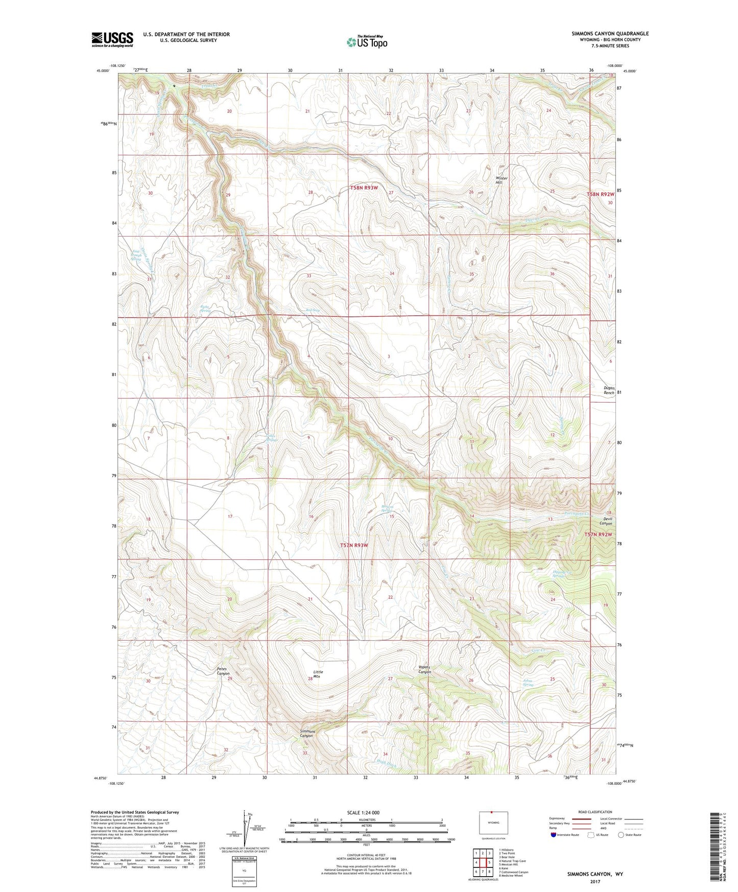
2021 topographic map quadrangle Simmons Canyon in the states of Wyoming, Montana. Scale: 1:24000. Based on the newly updated USGS 7.5' US Topo map series, this map is in the following counties: Big Horn. The map contains contour data, water features, and other items you are used to seeing on USGS maps, but also has updated roads and other features. This is the next generation of topographic maps. Printed on high-quality waterproof paper with UV fade-resistant inks.
Quads adjacent to this one:
West: Natural Trap Cave
Northwest: Hillsboro
North: Two Point
Northeast: Bear Hole
East: Mexican Hill
Southeast: Medicine Wheel
South: Cottonwood Canyon
Southwest: Kane
This map covers the same area as the classic USGS quad with code o44108h1.
Contains the following named places: Browns Spring, Burnt Trail, Cow Creek, Deer Creek, Dipping Vat Springs, Dugan Bench, East Trough Spring, Godes Springs, Johns Spring, Little Mountain, Moss Ranch, North Fork Trout Creek, Oasis Spring Creek, Petes Canyon, Red Seep, Richs Spring, Simmons Canyon, Spring Creek, Trout Creek, Vopats Canyon, Winter Hill