MyTopo
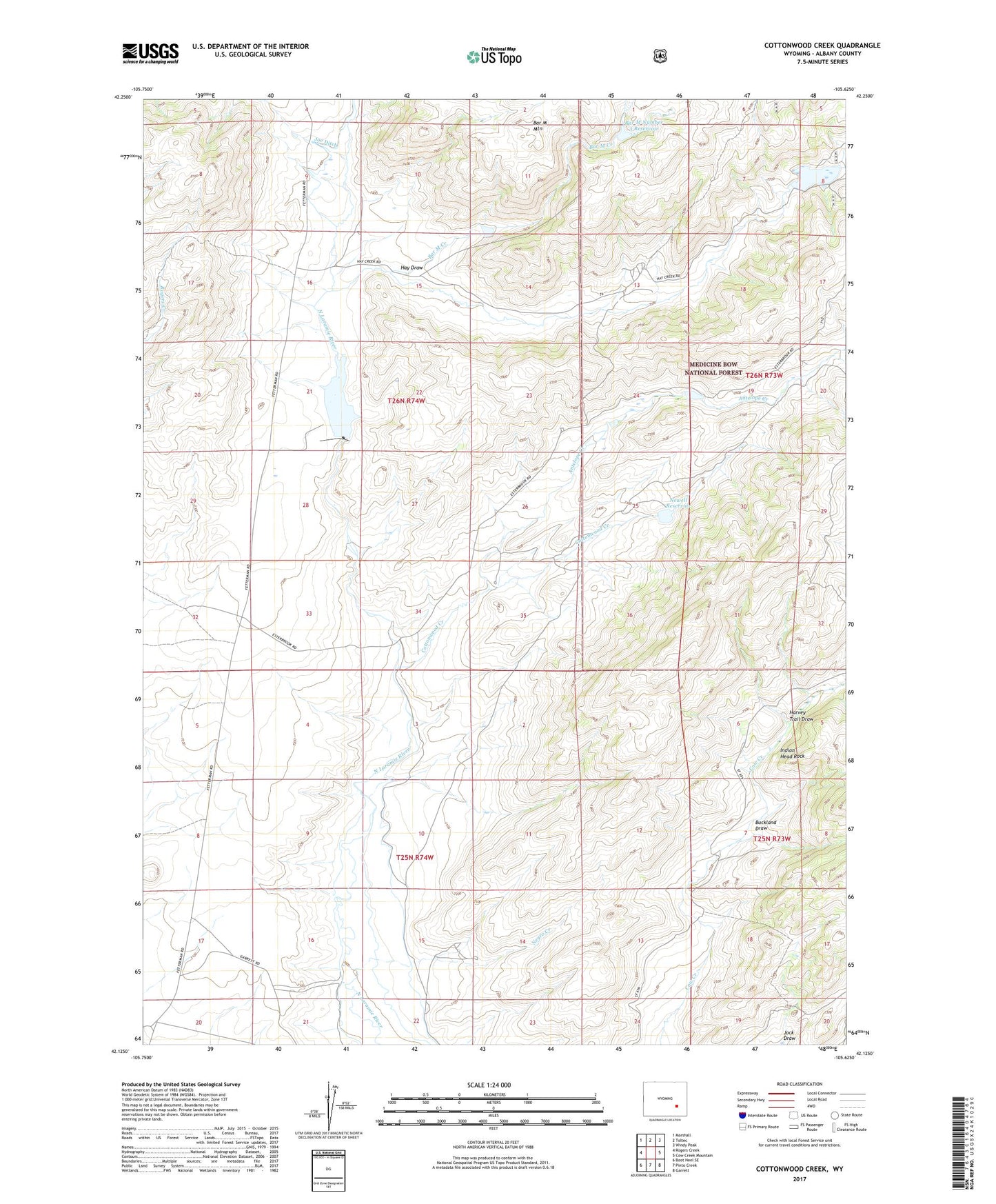
Cottonwood Creek Wyoming US Topo Map
Couldn't load pickup availability
Also explore the Cottonwood Creek Forest Service Topo of this same quad for updated USFS data
2021 topographic map quadrangle Cottonwood Creek in the state of Wyoming. Scale: 1:24000. Based on the newly updated USGS 7.5' US Topo map series, this map is in the following counties: Albany. The map contains contour data, water features, and other items you are used to seeing on USGS maps, but also has updated roads and other features. This is the next generation of topographic maps. Printed on high-quality waterproof paper with UV fade-resistant inks.
Quads adjacent to this one:
West: Rogers Creek
Northwest: Marshall
North: Toltec
Northeast: Windy Peak
East: Cow Creek Mountain
Southeast: Garrett
South: Pinto Creek
Southwest: Boot Heel SE
This map covers the same area as the classic USGS quad with code o42105b6.
Contains the following named places: Antelope Creek, Antelope Creek School, Bar M Creek, Bar M Number 1 Dam, Bar M Number 1 Reservoir, Bar M Number 2 Reservoir, Bar M Number 3 Dam, Bar M Number 3 Reservoir, Bridge Draw, Buckland Draw, Cottonwood Creek, Harvey Trail Draw, Hay Draw, Indian Head Rock, Joe Ditch, Negro Creek, Newell Dam, Newell Reservoir