MyTopo
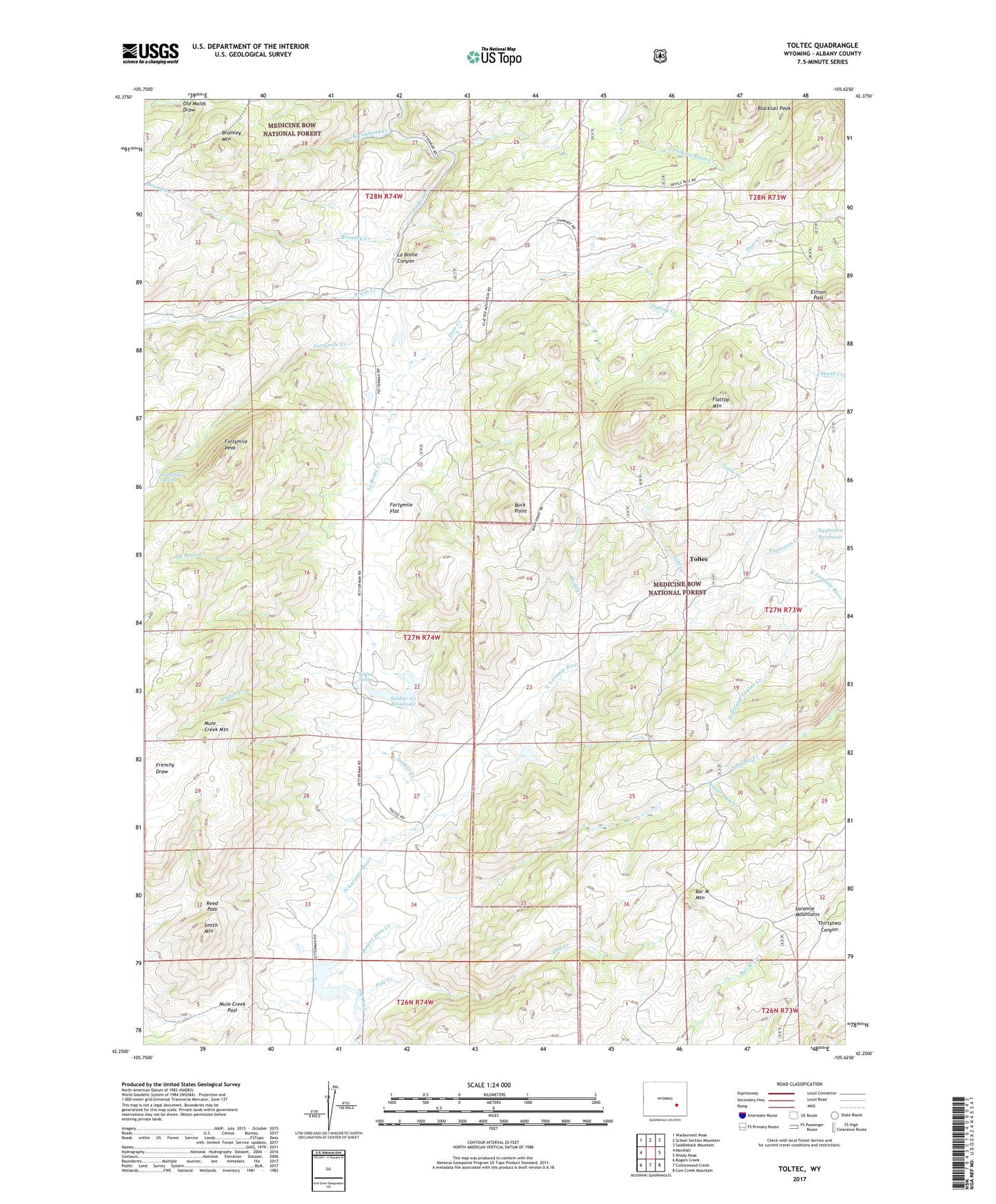
Toltec Wyoming US Topo Map
Couldn't load pickup availability
Also explore the Toltec Forest Service Topo of this same quad for updated USFS data
2021 topographic map quadrangle Toltec in the state of Wyoming. Scale: 1:24000. Based on the newly updated USGS 7.5' US Topo map series, this map is in the following counties: Albany. The map contains contour data, water features, and other items you are used to seeing on USGS maps, but also has updated roads and other features. This is the next generation of topographic maps. Printed on high-quality waterproof paper with UV fade-resistant inks.
Quads adjacent to this one:
West: Marshall
Northwest: Warbonnett Peak
North: School Section Mountain
Northeast: Saddleback Mountain
East: Windy Peak
Southeast: Cow Creek Mountain
South: Cottonwood Creek
Southwest: Rogers Creek
This map covers the same area as the classic USGS quad with code o42105c6.
Contains the following named places: Albany Number One Claim, Arrowhead Creek, Bar M Number 2 Dam, Beaver Dam Creek, Bell and Scranton Number 1 Dam, Bell and Scranton Number 1 Reservoir, Blacktail Peak, Brumley Creek, Brumley Mountain, Brush Creek, Buck Point, Cold Creek, Deer Creek, Eggleston Creek, Eggleston Reservoir, Ellison Pass, Flattop Creek, Flattop Mountain, Fortymile Creek, Fortymile Flat, Fortymile Peak, Fortymile Spring, Kafka Number 1 Dam, Kafka Number 1 Reservoir, Muddy Creek, Mule Creek Mountain, Mule Creek Pass, Phillips Number 1 Dam, Phillips Number 1 Reservoir, Pole Creek, Reed Pass, Reed Place, Smith Mountain, Soldier Creek, Soldier Creek Reservoir, Soldier Spring, Squaw Place, Stove and Timber Creek, Toltec, Tuttle Creek