MyTopo
Cottonwood Pass Wyoming US Topo Map
Couldn't load pickup availability
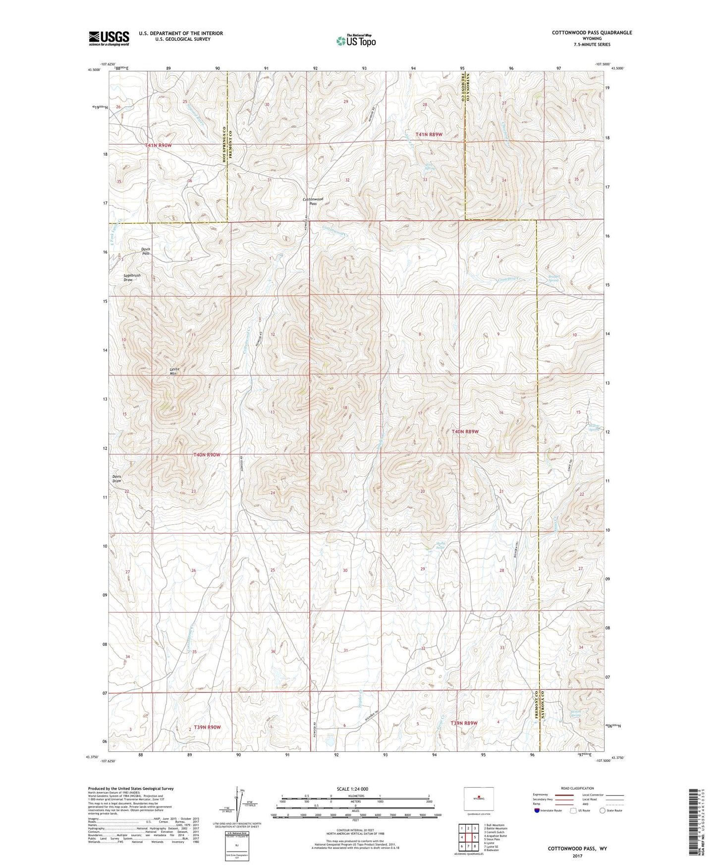
2021 topographic map quadrangle Cottonwood Pass in the state of Wyoming. Scale: 1:24000. Based on the newly updated USGS 7.5' US Topo map series, this map is in the following counties: Fremont, Natrona, Hot Springs. The map contains contour data, water features, and other items you are used to seeing on USGS maps, but also has updated roads and other features. This is the next generation of topographic maps. Printed on high-quality waterproof paper with UV fade-resistant inks.
Quads adjacent to this one:
West: Arapahoe Butte
Northwest: Bull Mountain
North: Battle Mountain
Northeast: Cornell Gulch
East: Sioux Pass
Southeast: Badwater
South: Lysite SE
Southwest: Lysite
Contains the following named places: Bader Homestead, Brasket Spring, Britain Ranch, Cottonwood Pass, Davis Pass, Ellsworth Claim, Henry Place, Johnson Place, Lysite Mountain, McWilliams Homestead, Nichols Ranch, Shelly Seeps, Snyder Place, Stove Spring, Swaim Spring, Willow Spring