MyTopo
Bull Mountain Wyoming US Topo Map
Couldn't load pickup availability
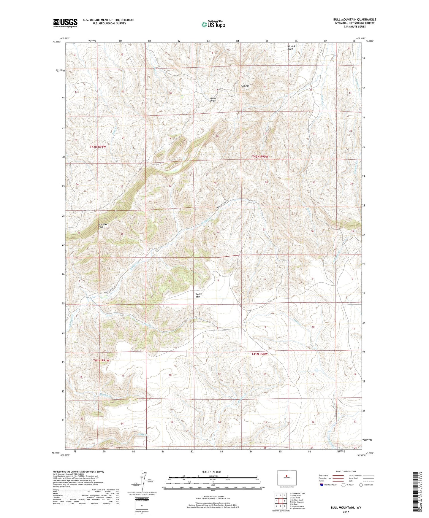
2021 topographic map quadrangle Bull Mountain in the state of Wyoming. Scale: 1:24000. Based on the newly updated USGS 7.5' US Topo map series, this map is in the following counties: Hot Springs. The map contains contour data, water features, and other items you are used to seeing on USGS maps, but also has updated roads and other features. This is the next generation of topographic maps. Printed on high-quality waterproof paper with UV fade-resistant inks.
Quads adjacent to this one:
West: Rathbun Ranch
Northwest: Packsaddle Creek
North: Bader Draw
Northeast: Sand Point
East: Battle Mountain
Southeast: Cottonwood Pass
South: Arapahoe Butte
Southwest: De Pass
This map covers the same area as the classic USGS quad with code o43107e6.
Contains the following named places: Bloomquist Ranch, Bull Mountain, Cochran Ranch, David McCarthy Ranch, Edwards Ranch, Gardner Number 3 Dam, Gardner Ranch, Gardner Reservoir Number 3, Justin McCarthy Ranch, Klondike Peak, Minnick Basin, Pine Creek