MyTopo
Arapahoe Butte Wyoming US Topo Map
Couldn't load pickup availability
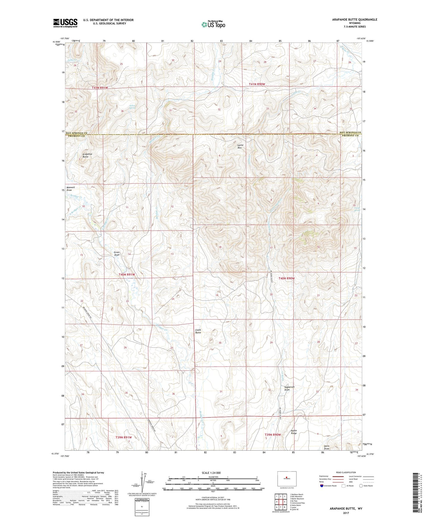
2021 topographic map quadrangle Arapahoe Butte in the state of Wyoming. Scale: 1:24000. Based on the newly updated USGS 7.5' US Topo map series, this map is in the following counties: Fremont, Hot Springs. The map contains contour data, water features, and other items you are used to seeing on USGS maps, but also has updated roads and other features. This is the next generation of topographic maps. Printed on high-quality waterproof paper with UV fade-resistant inks.
Quads adjacent to this one:
West: De Pass
Northwest: Rathbun Ranch
North: Bull Mountain
Northeast: Battle Mountain
East: Cottonwood Pass
Southeast: Lysite SE
South: Lysite
Southwest: Gates Butte
This map covers the same area as the classic USGS quad with code o43107d6.
Contains the following named places: Arapahoe Butte, Bow and Arrow Ranch, Chalk Butte, East Bridger Creek, East Fork Lysite Creek, Greer Draw, Mack Ranch, Mag Number One Mine, Maxwell Draw, Meadow Creek, Puzzle Spring, Ramage Ranch, Reck Ranch, Sagebrush Draw, South Bridger Creek, Willow Spring