MyTopo
Coyote Springs Wyoming US Topo Map
Couldn't load pickup availability
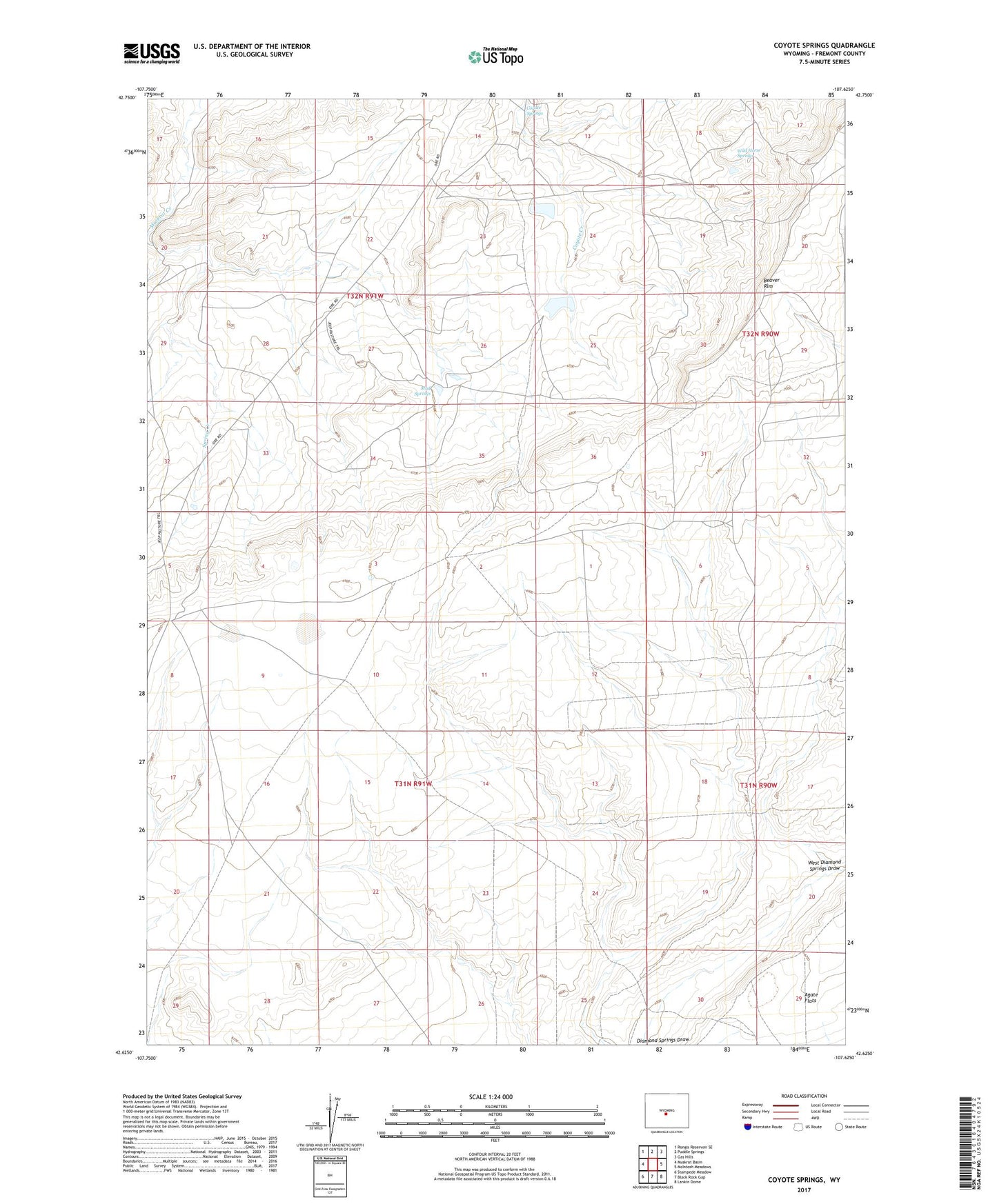
2021 topographic map quadrangle Coyote Springs in the state of Wyoming. Scale: 1:24000. Based on the newly updated USGS 7.5' US Topo map series, this map is in the following counties: Fremont. The map contains contour data, water features, and other items you are used to seeing on USGS maps, but also has updated roads and other features. This is the next generation of topographic maps. Printed on high-quality waterproof paper with UV fade-resistant inks.
Quads adjacent to this one:
West: Muskrat Basin
Northwest: Rongis Reservoir SE
North: Puddle Springs
Northeast: Gas Hills
East: McIntosh Meadows
Southeast: Lankin Dome
South: Black Rock Gap
Southwest: Stampede Meadow
This map covers the same area as the classic USGS quad with code o42107f6.
Contains the following named places: B. T. W. Number Eighteen Mine, Bum Steer Number One Mine, Clyde A B A-1 A2C Mine, Clyde Bret Mine, Clyde Mine, Clyde Mines, Clyde Number Five Mine, Clyde Number Three Mine, Coco Underground Number One Mine, Coyote Springs, Day Mine, Day Number Twenty-six Mine, Day Ore Pad Dam, Day Ore Pad Reservoir, Day South Dam, Day South Reservoir, Diamond Springs Well, East Dam, East Reservoir, Federal American Open Pit, Keeno Number One Mine, Loco Bret A2C C-2 Number One Mine, Loco C Mine, Loco D Mine, Loco M L K Mine, Loco N-1 N-2 Mine, Loma Mine Group, Loma-Day Claims, Mud Springs, Nels Number Eight Mine, Nels Number Twenty Mine, Reno Number One Mine, RMCC Number Eight Mine, Spring Creek, The Dry Lakes, West Diamond Springs Draw, Wild Horse Springs