MyTopo
Black Rock Gap Wyoming US Topo Map
Couldn't load pickup availability
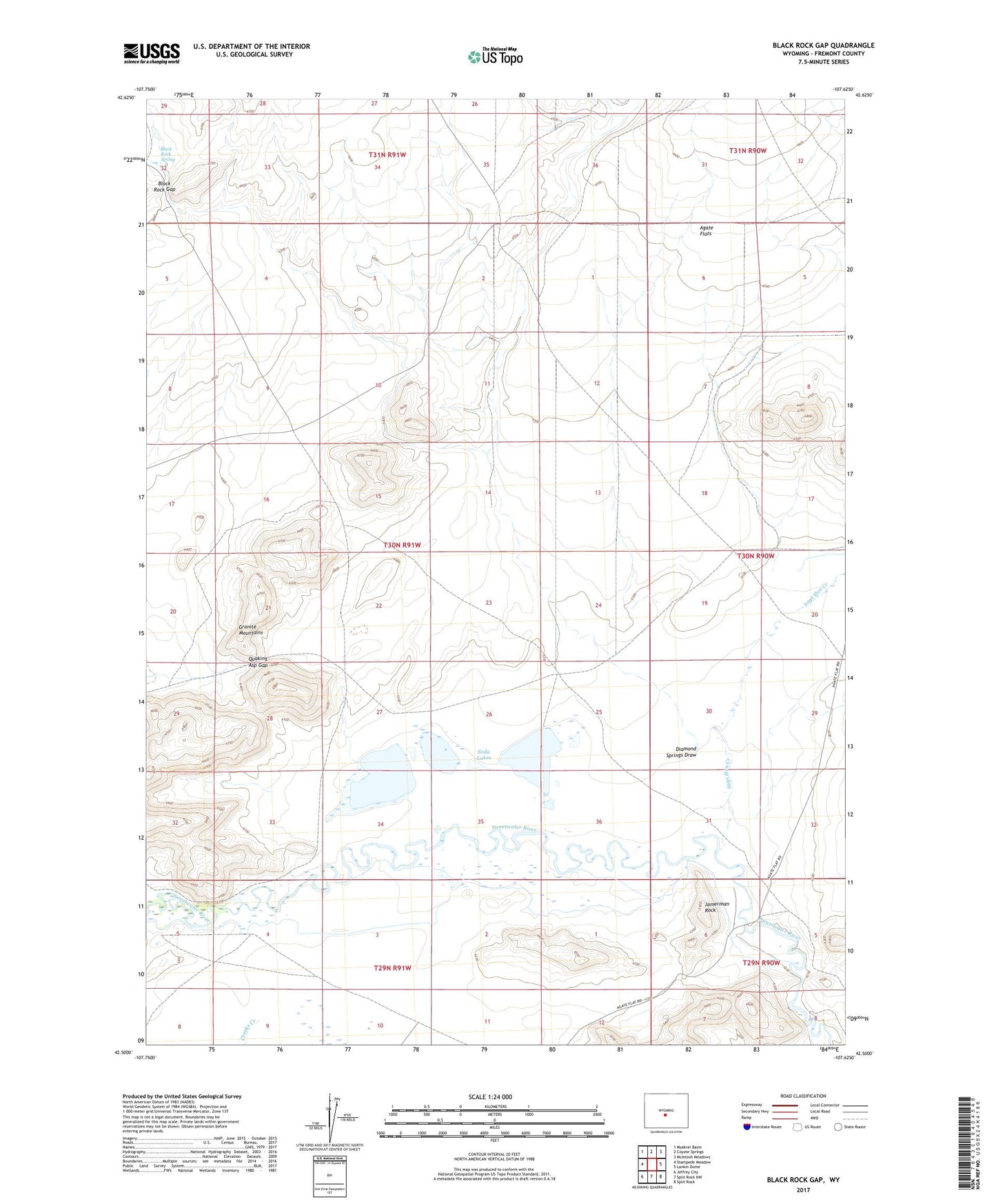
2021 topographic map quadrangle Black Rock Gap in the state of Wyoming. Scale: 1:24000. Based on the newly updated USGS 7.5' US Topo map series, this map is in the following counties: Fremont. The map contains contour data, water features, and other items you are used to seeing on USGS maps, but also has updated roads and other features. This is the next generation of topographic maps. Printed on high-quality waterproof paper with UV fade-resistant inks.
Quads adjacent to this one:
West: Stampede Meadow
Northwest: Muskrat Basin
North: Coyote Springs
Northeast: McIntosh Meadows
East: Lankin Dome
Southeast: Split Rock
South: Split Rock NW
Southwest: Jeffrey City
This map covers the same area as the classic USGS quad with code o42107e6.
Contains the following named places: Black Rock Draw, Black Rock Gap, Black Rock Spring, Crooks Creek, Diamond Springs Draw, Dome Rock Dam, Jamerman Rock, Quaking Asp Gap, Sage Hen Creek, Soda Lakes