MyTopo
Crooks Peak Wyoming US Topo Map
Couldn't load pickup availability
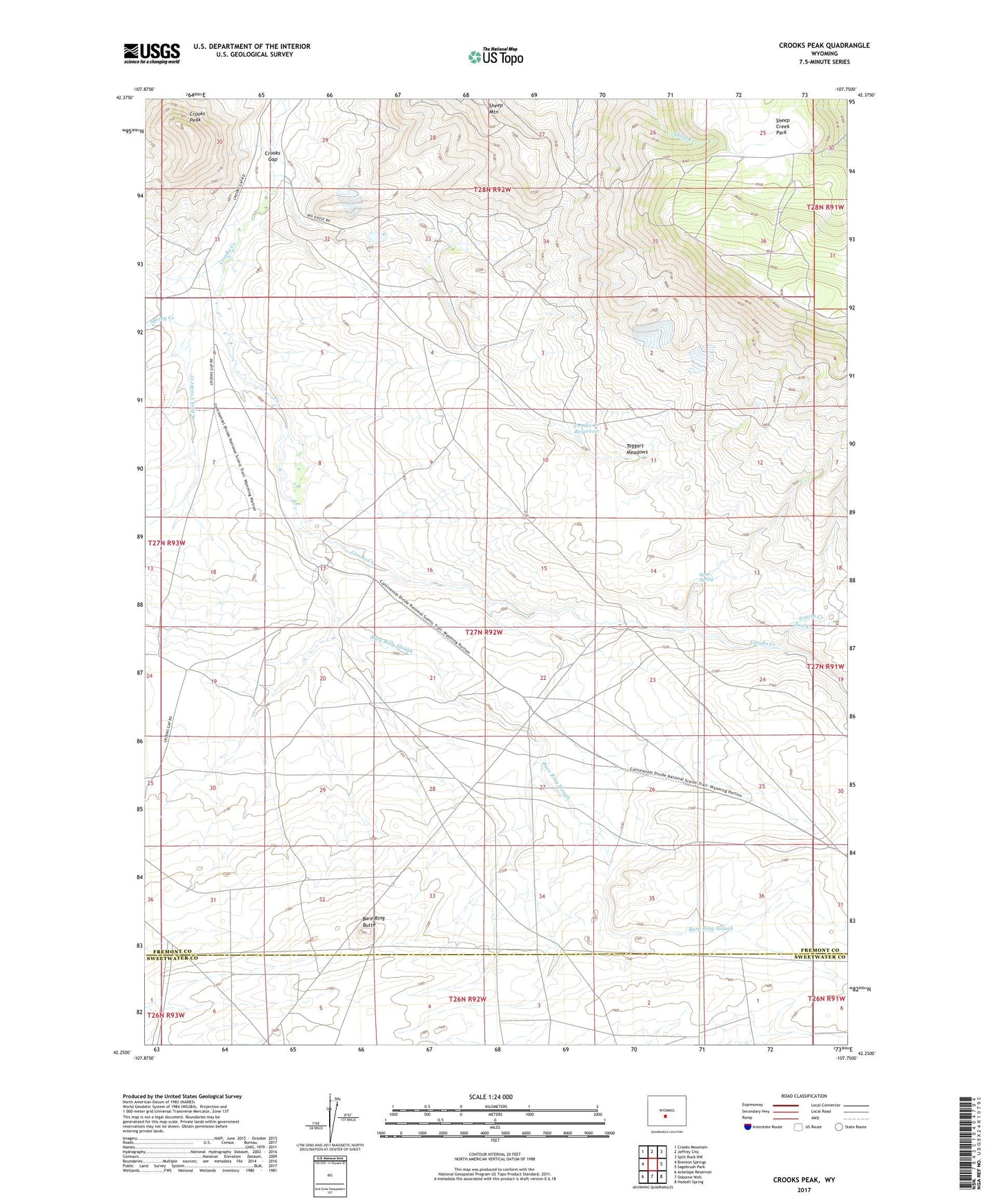
2021 topographic map quadrangle Crooks Peak in the state of Wyoming. Scale: 1:24000. Based on the newly updated USGS 7.5' US Topo map series, this map is in the following counties: Fremont, Sweetwater. The map contains contour data, water features, and other items you are used to seeing on USGS maps, but also has updated roads and other features. This is the next generation of topographic maps. Printed on high-quality waterproof paper with UV fade-resistant inks.
Quads adjacent to this one:
West: Brenton Springs
Northwest: Crooks Mountain
North: Jeffrey City
Northeast: Split Rock NW
East: Sagebrush Park
Southeast: Hadsell Spring
South: Osborne Well
Southwest: Antelope Reservoir
This map covers the same area as the classic USGS quad with code o42107c7.
Contains the following named places: B Seventeen-Eighteen Mine, Bare Ring Butte, Bare Ring Slough, Big Bertha Mine, Big Eagle Mine, Butte Mine, Crooks Creek Reservoir, Crooks Gap, Crooks Peak, Fourth Creek, J.J Claims Number Four Mine, Jenson Ranch, Jost Creek, Lost Creek Claims, McIntosh Pit, McThomas Number Two Mine, Rock Dam, Rock Reservoir, Sand Spring, Sheep Creek Park, Sheep Mountain, Sheep Mountain Number One Mine, Snoball Mine, Snoball Number Three Mine, Spring Creek, Sun and Sunday Claims, Sun Number Four Mine, Sun Number Three P Sundog Number Two Mine, Taggart Meadows, Troy Number Thirteen Mine, Utah Mine, Waverly Claims, West Fork Crooks Creek