MyTopo
Crowheart Wyoming US Topo Map
Couldn't load pickup availability
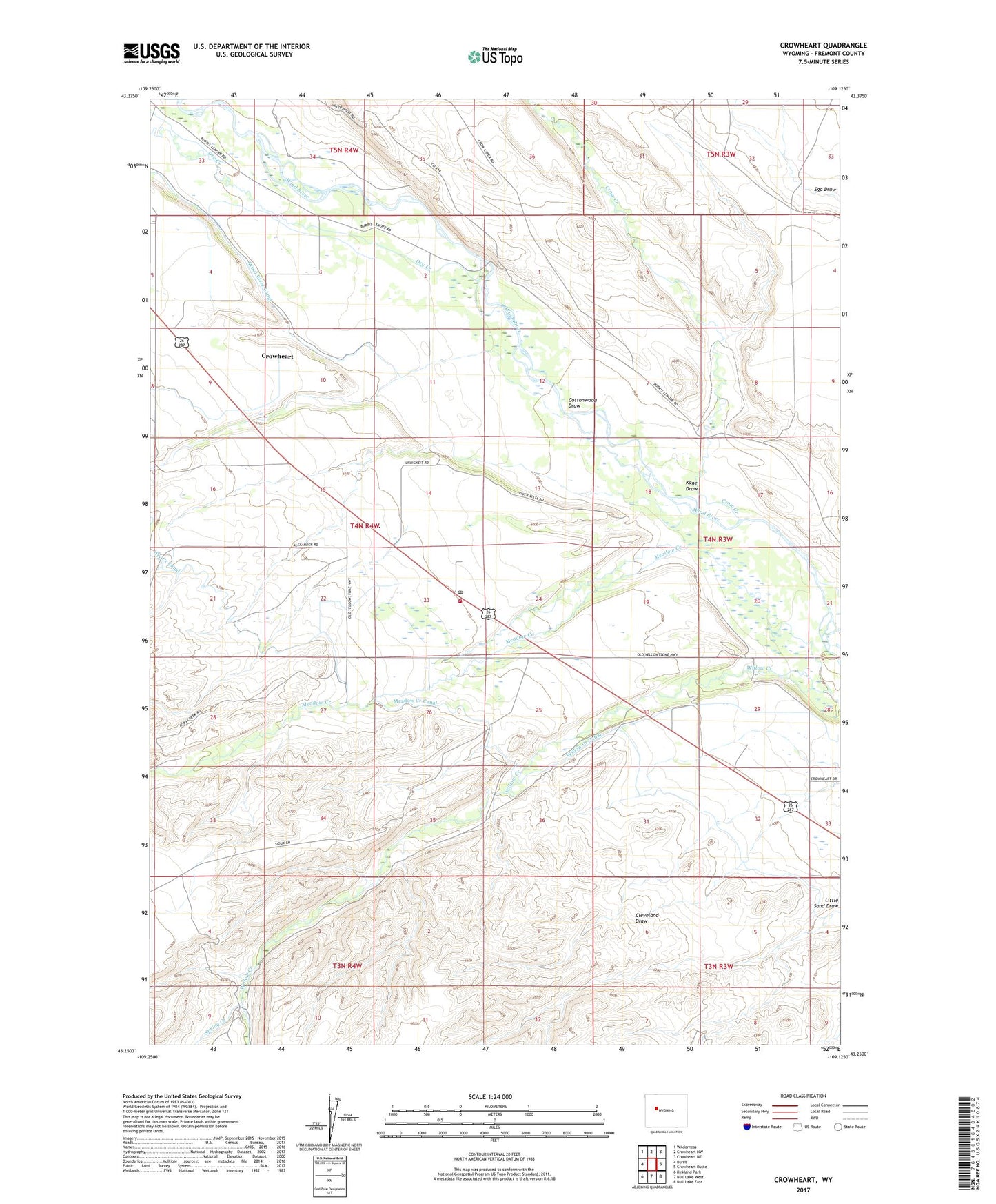
2021 topographic map quadrangle Crowheart in the state of Wyoming. Scale: 1:24000. Based on the newly updated USGS 7.5' US Topo map series, this map is in the following counties: Fremont. The map contains contour data, water features, and other items you are used to seeing on USGS maps, but also has updated roads and other features. This is the next generation of topographic maps. Printed on high-quality waterproof paper with UV fade-resistant inks.
Quads adjacent to this one:
West: Burris
Northwest: Wilderness
North: Crowheart NW
Northeast: Crowheart NE
East: Crowheart Butte
Southeast: Bull Lake East
South: Bull Lake West
Southwest: Kirkland Park
This map covers the same area as the classic USGS quad with code o43109c2.
Contains the following named places: Burris- Crowheart School, Cottonwood Draw, Crow Creek, Crowheart, Crowheart Census Designated Place, Crowheart Post Office, Crowheart School, Dry Creek, Fremont County Fire Protection District Battalion 6 Crowheart, Government Ditch Camp, Kane Draw, Meadow Creek, Meadow Creek Canal, Saint Helen Church, Spring Creek, Willow Creek, Willow Creek Canal, Wind River Canal