MyTopo
Bull Lake West Wyoming US Topo Map
Couldn't load pickup availability
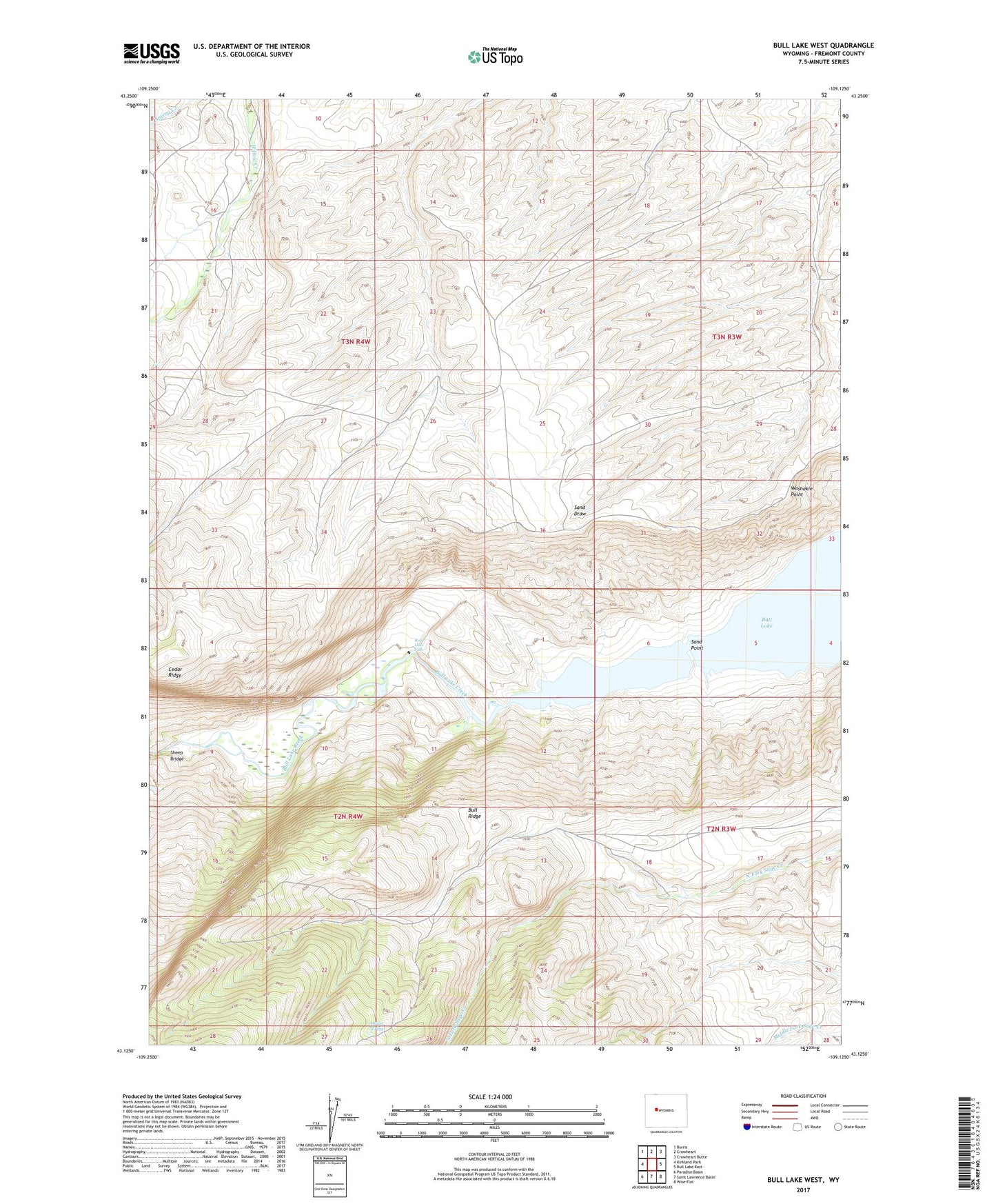
2021 topographic map quadrangle Bull Lake West in the state of Wyoming. Scale: 1:24000. Based on the newly updated USGS 7.5' US Topo map series, this map is in the following counties: Fremont. The map contains contour data, water features, and other items you are used to seeing on USGS maps, but also has updated roads and other features. This is the next generation of topographic maps. Printed on high-quality waterproof paper with UV fade-resistant inks.
Quads adjacent to this one:
West: Kirkland Park
Northwest: Burris
North: Crowheart
Northeast: Crowheart Butte
East: Bull Lake East
Southeast: Wise Flat
South: Saint Lawrence Basin
Southwest: Paradise Basin
This map covers the same area as the classic USGS quad with code o43109b2.
Contains the following named places: Austin Spring, Bull Lake Falls, Bull Ridge Mine, Ocean Lake Habitat Number 5 Dam, Ocean Lake Habitat Reservoir Number 5, Sand Point, Sheep Bridge, Washakie Point, Yellow Trail