MyTopo
Davis Hill Wyoming US Topo Map
Couldn't load pickup availability
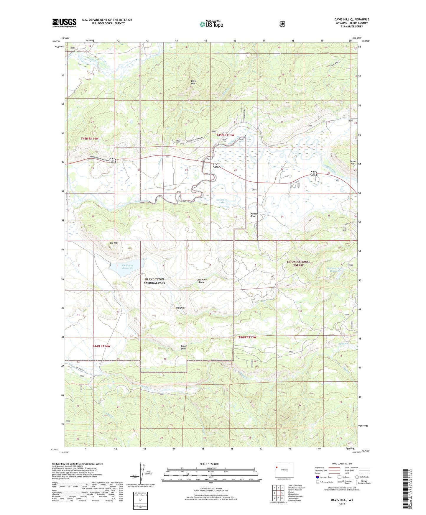
2021 topographic map quadrangle Davis Hill in the state of Wyoming. Scale: 1:24000. Based on the newly updated USGS 7.5' US Topo map series, this map is in the following counties: Teton. The map contains contour data, water features, and other items you are used to seeing on USGS maps, but also has updated roads and other features. This is the next generation of topographic maps. Printed on high-quality waterproof paper with UV fade-resistant inks.
Quads adjacent to this one:
West: Moran
Northwest: Two Ocean Lake
North: Whetstone Mountain
Northeast: Gravel Mountain
East: Rosies Ridge
Southeast: Green Mountain
South: Mount Leidy
Southwest: Shadow Mountain
Contains the following named places: Box K Ranch, Buffalo Valley Ranch, Burro Hill, Coal Creek, Coal Mine Draw, Davis Hill, Elk Ranch Reservoir, Eynon Draw, Halfmoon Lake, Heart Six Ranch, Johnson Mine, Lava Creek, Lava Creek Campground, Pinto Ranch, Porter Dam, Porter Reservoir, Rock Creek, Skull Creek, Three Rivers Ranch, Uhl Dam, Uhl Draw, Uhl Hill, Uhl Reservoir, Wallace Draw, Wallace Draw-Reservoir