MyTopo
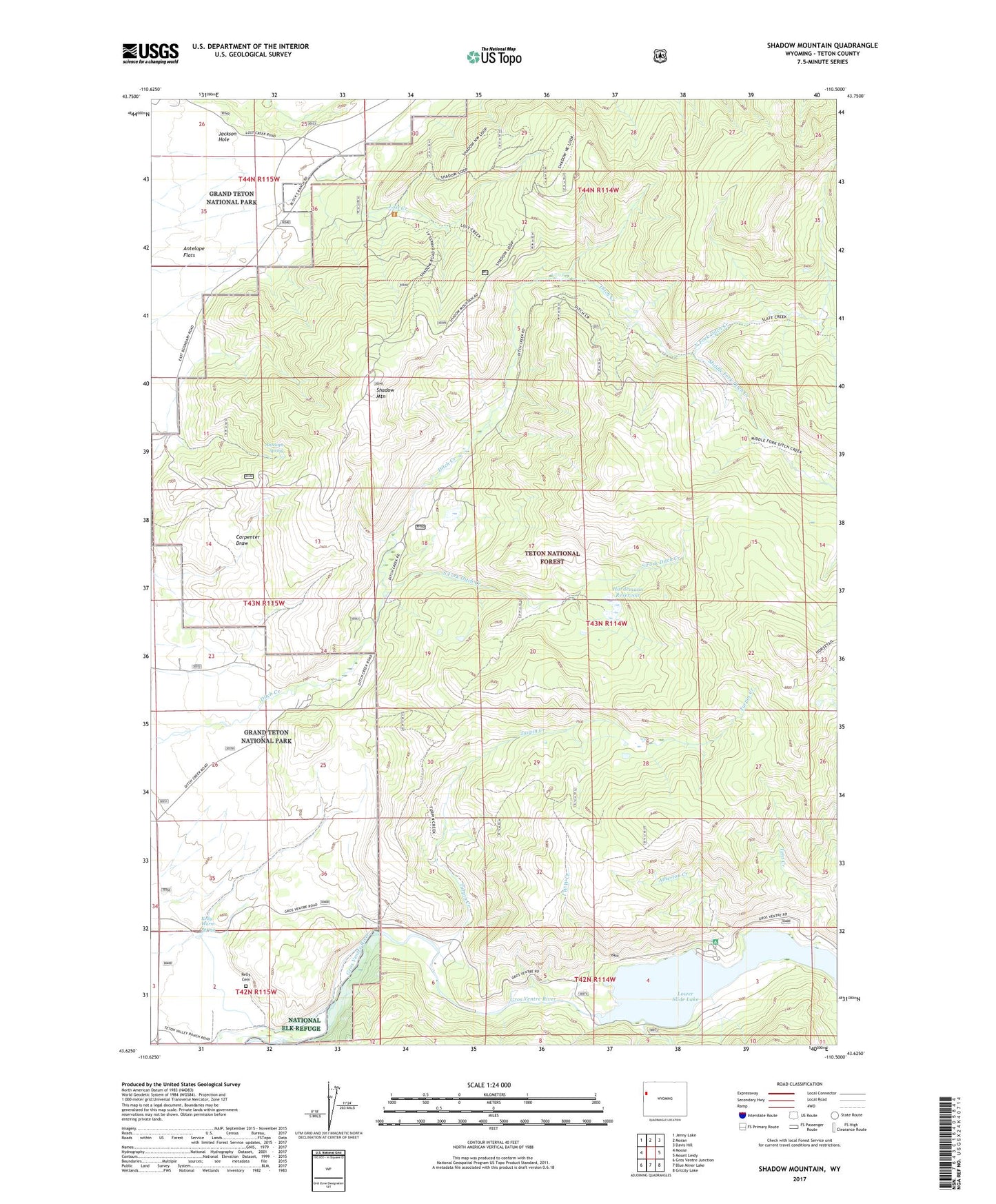
Shadow Mountain Wyoming US Topo Map
Couldn't load pickup availability
Also explore the Shadow Mountain Forest Service Topo of this same quad for updated USFS data
2021 topographic map quadrangle Shadow Mountain in the state of Wyoming. Scale: 1:24000. Based on the newly updated USGS 7.5' US Topo map series, this map is in the following counties: Teton. The map contains contour data, water features, and other items you are used to seeing on USGS maps, but also has updated roads and other features. This is the next generation of topographic maps. Printed on high-quality waterproof paper with UV fade-resistant inks.
Quads adjacent to this one:
West: Moose
Northwest: Jenny Lake
North: Moran
Northeast: Davis Hill
East: Mount Leidy
Southeast: Grizzly Lake
South: Blue Miner Lake
Southwest: Gros Ventre Junction
This map covers the same area as the classic USGS quad with code o43110f5.
Contains the following named places: Antelope Spring, Atherton Creek, Atherton Creek Campground, Bierer Creek, Gros Ventre Overlook, Hardeman Dam, Hardeman Reservoir, Hardemann Reservoir, Hardiman Number 2 Dam, I W W Creek, Kelly Cemetery, Kelly Warm Spring, Lost Creek, Lost Creek Ranch, Lower Slide Lake, Middle Fork Ditch Creek, North Fork Ditch Creek, Shadow Mountain, South Fork Ditch Creek, Tent Creek, Teton Science School, Turpin Creek