MyTopo
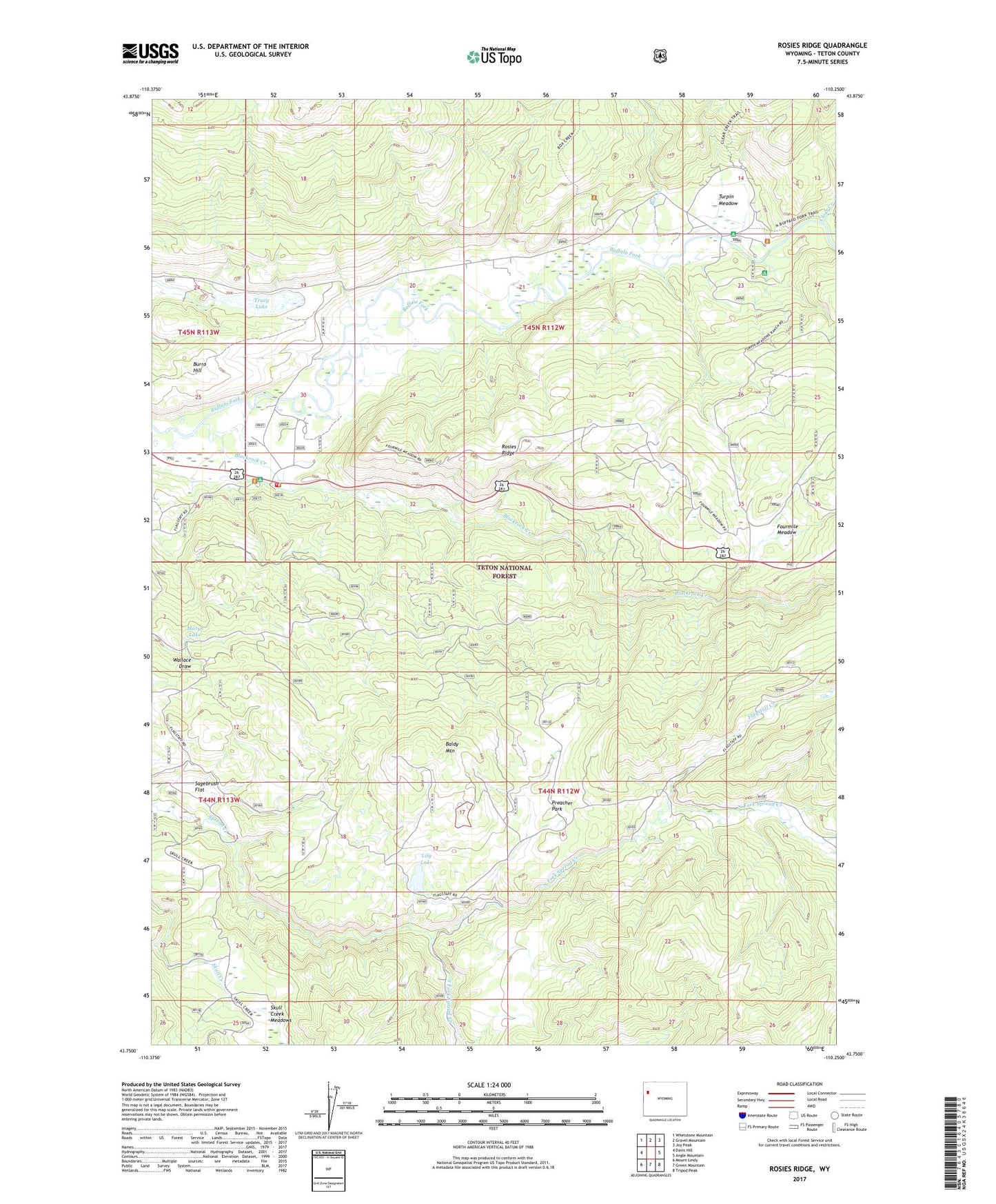
Rosies Ridge Wyoming US Topo Map
Couldn't load pickup availability
Also explore the Rosies Ridge Forest Service Topo of this same quad for updated USFS data
2021 topographic map quadrangle Rosies Ridge in the state of Wyoming. Scale: 1:24000. Based on the newly updated USGS 7.5' US Topo map series, this map is in the following counties: Teton. The map contains contour data, water features, and other items you are used to seeing on USGS maps, but also has updated roads and other features. This is the next generation of topographic maps. Printed on high-quality waterproof paper with UV fade-resistant inks.
Quads adjacent to this one:
West: Davis Hill
Northwest: Whetstone Mountain
North: Gravel Mountain
Northeast: Joy Peak
East: Angle Mountain
Southeast: Tripod Peak
South: Green Mountain
Southwest: Mount Leidy
This map covers the same area as the classic USGS quad with code o43110g3.
Contains the following named places: Baldy Mountain, Blackrock Creek, Blackrock Ranger District Office, Blackrock Ranger Station, Box Creek, Boy Creek Trailhead, Bridger - Teton National Forest Blackrock - Buffalo Ranger District Fire Engine Crew, Clear Creek Trail, Flagstaff Creek, Fourmile Meadow, Fourmile Meadow Picnic Area, Hatchet Campground, Lily Lake, Marys Lake, North Fork Spread Creek, Preacher Park, Rosies Ridge, Sagebrush Flat, Skull Creek Meadows, South Fork Spread Creek, Tracy Lake, Tracy Lake Dam, Turpin Meadow, Turpin Meadow Campground, Turpin Meadow Lodge, Turpin Meadow Trailhead