MyTopo
Devils Run Wyoming US Topo Map
Couldn't load pickup availability
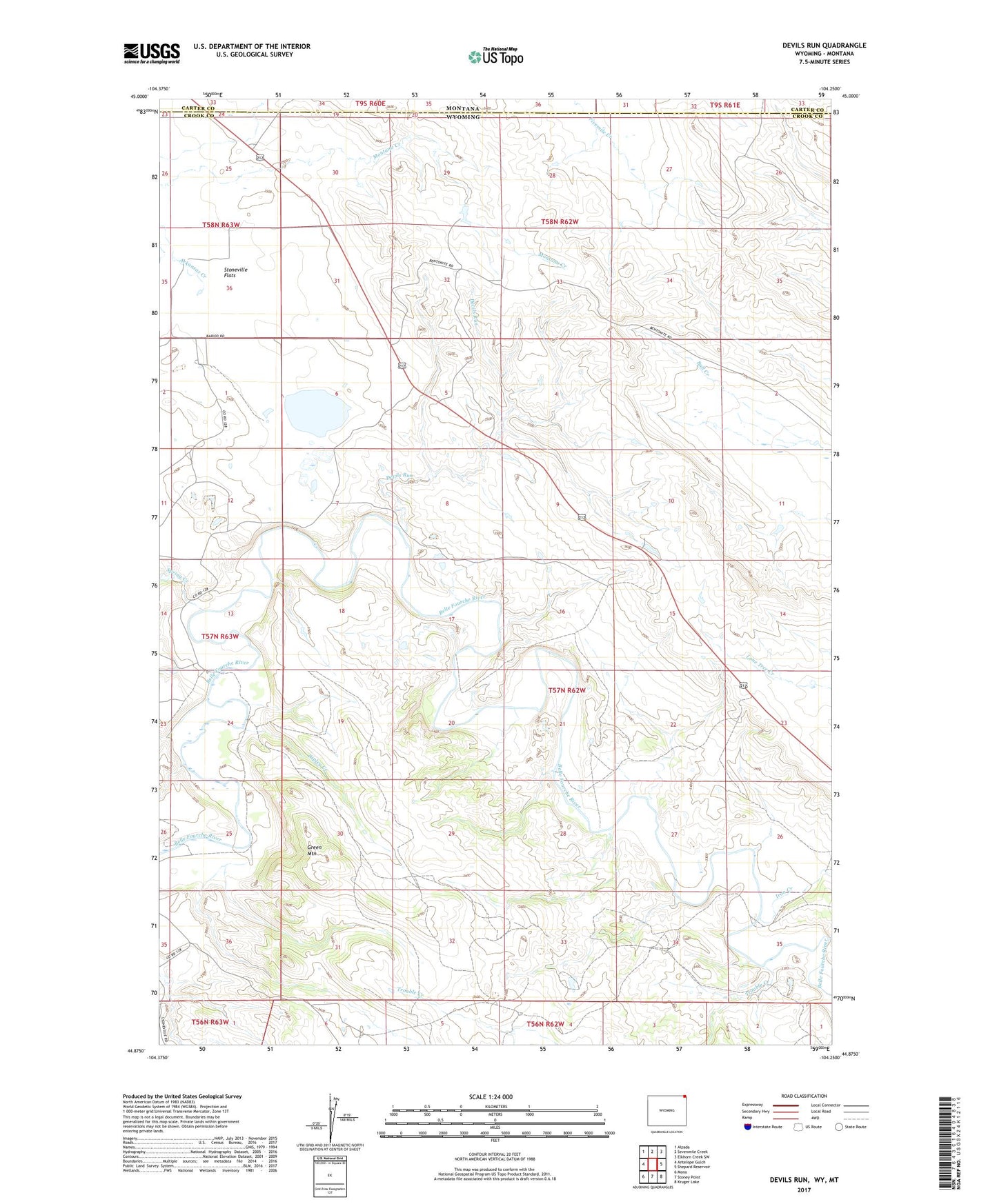
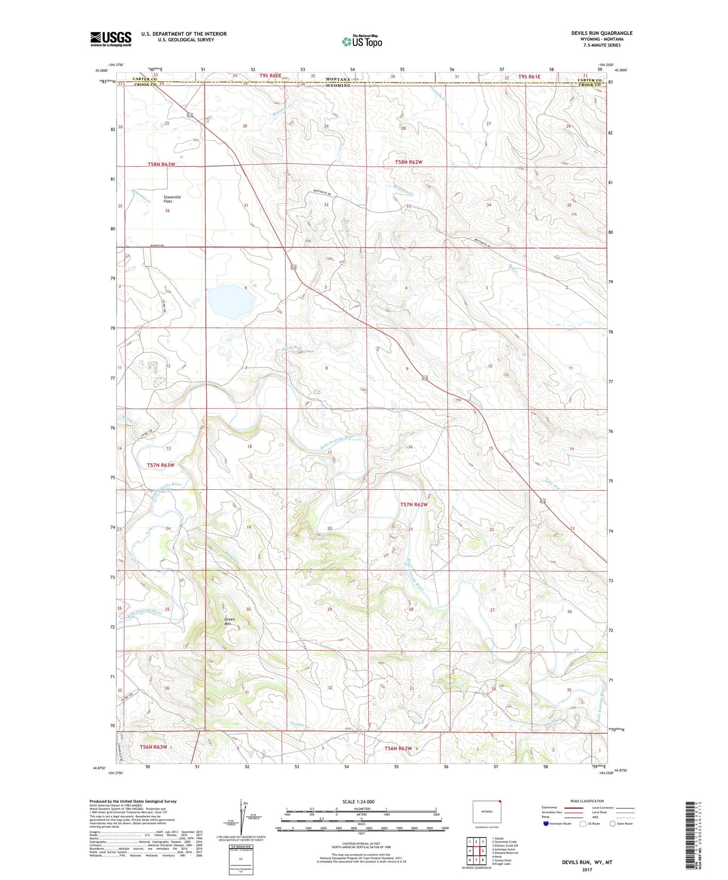
2021 topographic map quadrangle Devils Run in the states of Wyoming, Montana. Scale: 1:24000. Based on the newly updated USGS 7.5' US Topo map series, this map is in the following counties: Crook, Carter. The map contains contour data, water features, and other items you are used to seeing on USGS maps, but also has updated roads and other features. This is the next generation of topographic maps. Printed on high-quality waterproof paper with UV fade-resistant inks.
Quads adjacent to this one:
West: Antelope Gulch
Northwest: Alzada
North: Sevenmile Creek
Northeast: Elkhorn Creek SW
East: Shepard Reservoir
Southeast: Kruger Lake
South: Stoney Point
Southwest: Mona
Contains the following named places: 09S61E31CCCC01 Well, Bean Ranch, Coburn Ranch, Devils Run, Green Mountain, Iron Creek, King Number 1 Dam, King Number 1 Reservoir, Montana Creek Mine, Newby Creek Dam, Newby Creek Reservoir, Newland Number 4 Dam, Newland Number 4 Reservoir, Raber Ranch, Ripley Creek, Robinson Ranch, Robinson School, Spring Creek, Stoneville Flats, Trouble Creek