MyTopo
Antelope Gulch Wyoming US Topo Map
Couldn't load pickup availability
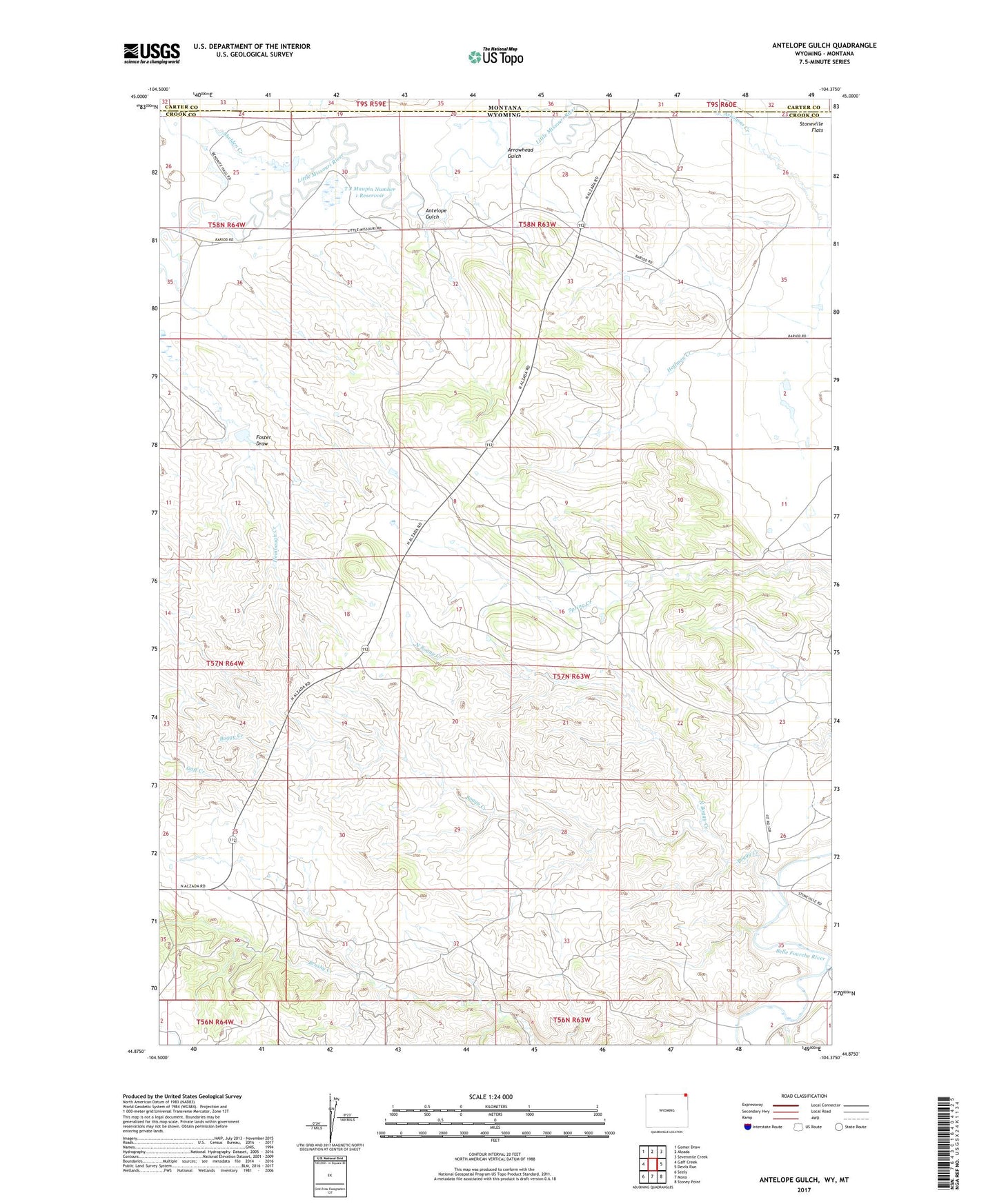
2021 topographic map quadrangle Antelope Gulch in the state of Wyoming. Scale: 1:24000. Based on the newly updated USGS 7.5' US Topo map series, this map is in the following counties: Crook, Carter. The map contains contour data, water features, and other items you are used to seeing on USGS maps, but also has updated roads and other features. This is the next generation of topographic maps. Printed on high-quality waterproof paper with UV fade-resistant inks.
Quads adjacent to this one:
West: Gaff Creek
Northwest: Gomer Draw
North: Alzada
Northeast: Sevenmile Creek
East: Devils Run
Southeast: Stoney Point
South: Mona
Southwest: Seely
This map covers the same area as the classic USGS quad with code o44104h4.
Contains the following named places: Antelope Gulch, Antelope Gulch School, Arrowhead Gulch, Banks Creek Dam, Banks Creek Reservoir, Boggy Creek, C Cockran Mine, Cochrun Ranch, Edsall Ranch, Foster Draw, Foster Ranch, Gimmestad Creek, Harney Ranch, Heinbaugh Creek, Hoffman Creek, Maupin Ranch, Montana Creek, North Boggy Creek, Ridinger Junior Ranch, Ridinger Ranch, Shelden Creek, T J Maupin Number 1 Dam, T J Maupin Number 1 Reservoir