MyTopo
Elkhorn Creek SW Montana US Topo Map
Couldn't load pickup availability
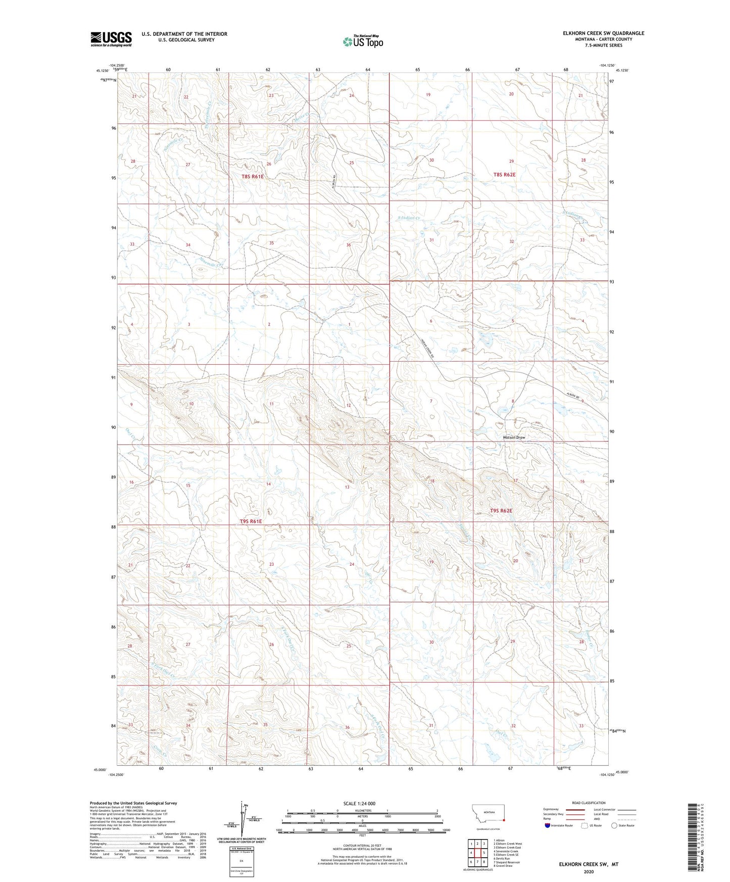
2024 topographic map quadrangle Elkhorn Creek SW in the state of Montana. Scale: 1:24000. Based on the newly updated USGS 7.5' US Topo map series, this map is in the following counties: Carter. The map contains contour data, water features, and other items you are used to seeing on USGS maps, but also has updated roads and other features. This is the next generation of topographic maps. Printed on high-quality waterproof paper with UV fade-resistant inks.
Quads adjacent to this one:
West: Sevenmile Creek
Northwest: Albion
North: Elkhorn Creek West
Northeast: Elkhorn Creek East
East: Elkhorn Creek SE
Southeast: Gravel Draw
South: Shepard Reservoir
Southwest: Devils Run
This map covers the same area as the classic USGS quad with code o45104a2.
Contains the following named places: 08S62E19DCDD01 Well, 09S62E08CDCD01 Well