MyTopo
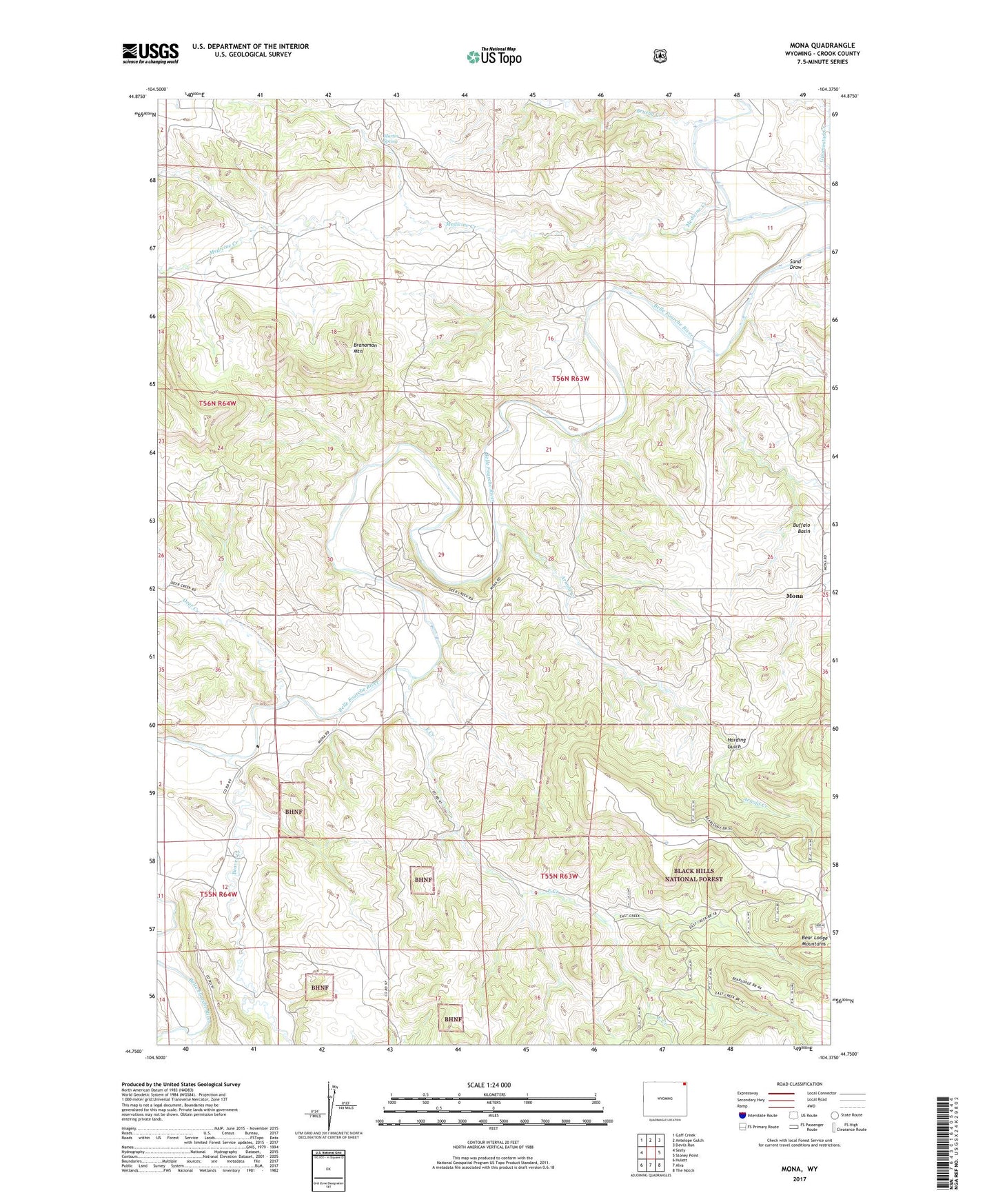
Mona Wyoming US Topo Map
Couldn't load pickup availability
Also explore the Mona Forest Service Topo of this same quad for updated USFS data
2021 topographic map quadrangle Mona in the state of Wyoming. Scale: 1:24000. Based on the newly updated USGS 7.5' US Topo map series, this map is in the following counties: Crook. The map contains contour data, water features, and other items you are used to seeing on USGS maps, but also has updated roads and other features. This is the next generation of topographic maps. Printed on high-quality waterproof paper with UV fade-resistant inks.
Quads adjacent to this one:
West: Seely
Northwest: Gaff Creek
North: Antelope Gulch
Northeast: Devils Run
East: Stoney Point
Southeast: The Notch
South: Alva
Southwest: Hulett
This map covers the same area as the classic USGS quad with code o44104g4.
Contains the following named places: Arnold Creek, Beaver Creek, Branaman Mountain, Brushy Creek, Buffalo Basin, Bunney Ranch, Cross Anchor Ranch, Deer Creek, Deer Creek School, Driskill Dam, Driskill Reservoir, East Creek, Gladson Creek, Harding Gulch, Mahoney Ranch, Martin Spring, McClure Ranch, Medicine Creek, Mona, Pannell Ranch, Red Arrow Dam, Red Arrow Reservoir, Sand Draw, Storm Ranch, Svoboda Ranch, T Cross T Ranch, Terhune, Viergutz Three Mine, Viergutz Two Mine