
MyTopo
Devils Tower Wyoming US Topo Map
Couldn't load pickup availability
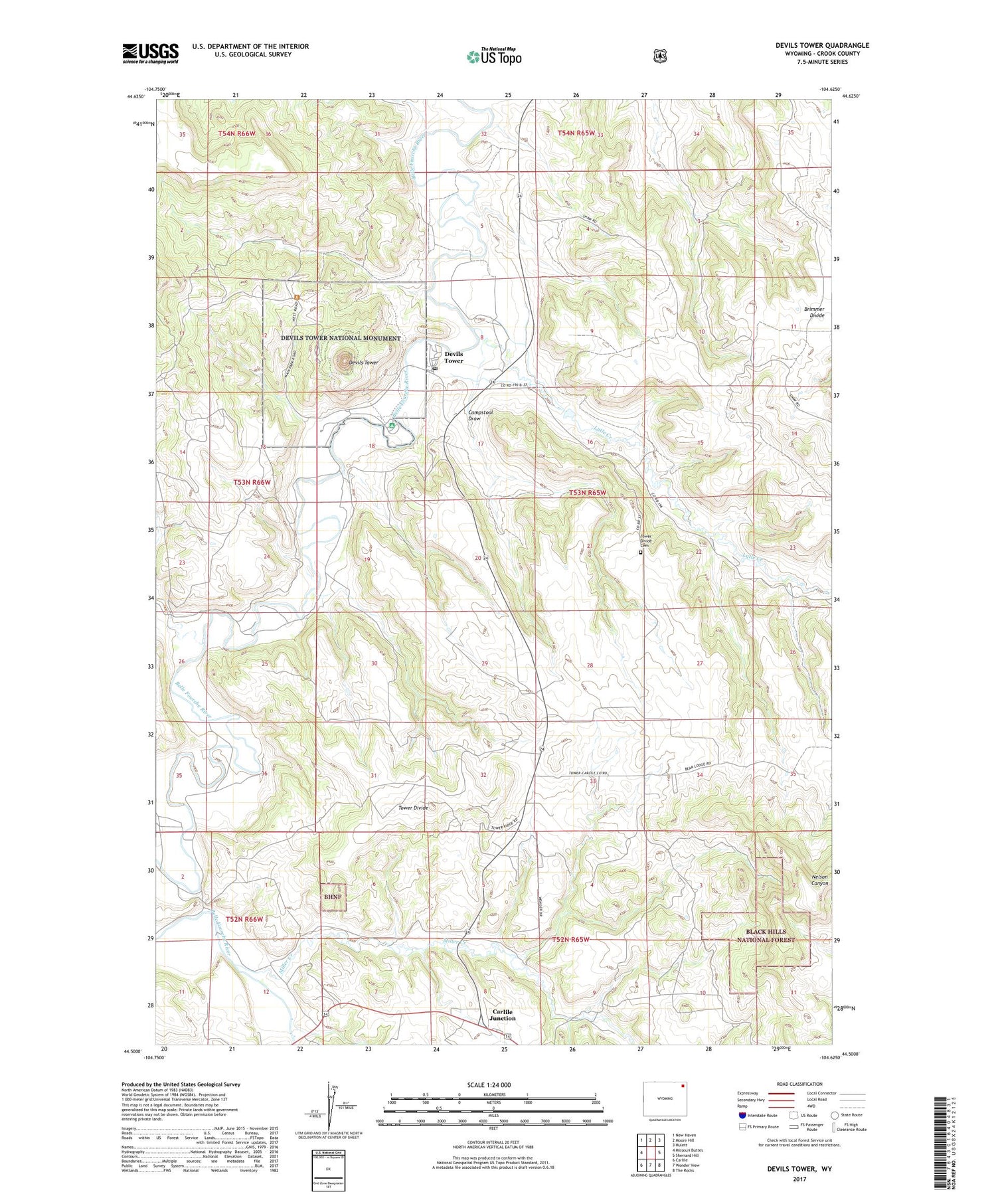
2021 topographic map quadrangle Devils Tower in the state of Wyoming. Scale: 1:24000. Based on the newly updated USGS 7.5' US Topo map series, this map is in the following counties: Crook. The map contains contour data, water features, and other items you are used to seeing on USGS maps, but also has updated roads and other features. This is the next generation of topographic maps. Printed on high-quality waterproof paper with UV fade-resistant inks.
Quads adjacent to this one:
West: Missouri Buttes
Northwest: New Haven
North: Moore Hill
Northeast: Hulett
East: Sherrard Hill
Southeast: The Rocks
South: Wonder View
Southwest: Carlile
Contains the following named places: Belle Fourche River Number Two Mine, Bitter Springs School, Brimmer Divide, Brimmer School, Butte Divide, Campstool Draw, Campstool Eleven Mine, Campstool Nine Mine, Campstool Ranch, Campstool School, Carlile Junction, Claudie Dam, Claudie Reservoir, Devils Tower, Devils Tower National Monument, Devils Tower Post Office, Left Creek, Lytle Creek, Miller Creek, Nubeth Joint Venture Mine, PIC Ranch, PIC School, Tower Divide, Tower Divide Cemetery, Tower Divide School, ZIP Code: 82714


