MyTopo
Carlile Wyoming US Topo Map
Couldn't load pickup availability
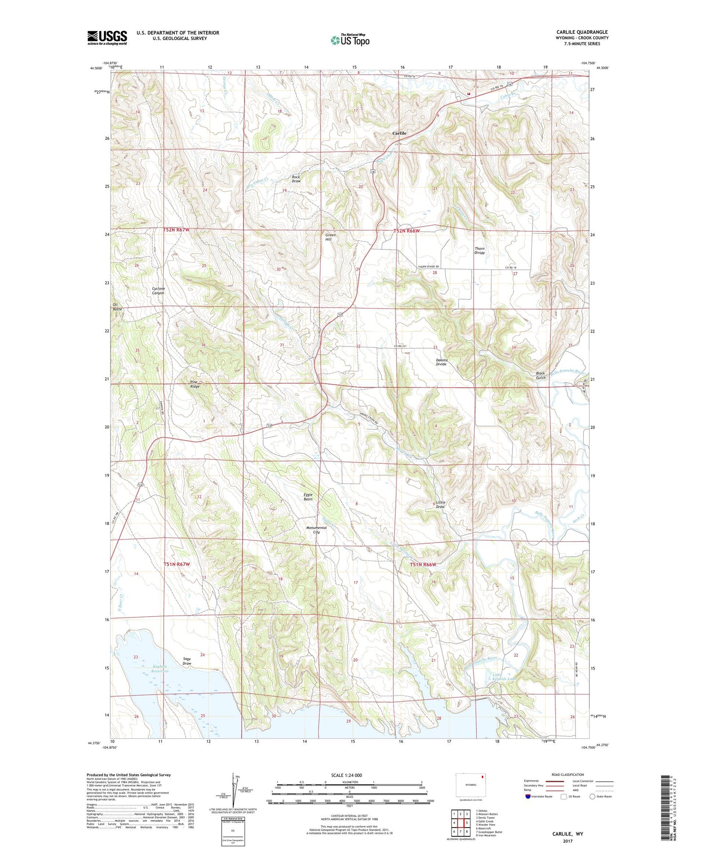
2021 topographic map quadrangle Carlile in the state of Wyoming. Scale: 1:24000. Based on the newly updated USGS 7.5' US Topo map series, this map is in the following counties: Crook. The map contains contour data, water features, and other items you are used to seeing on USGS maps, but also has updated roads and other features. This is the next generation of topographic maps. Printed on high-quality waterproof paper with UV fade-resistant inks.
Quads adjacent to this one:
West: Edith Creek
Northwest: Oshoto
North: Missouri Buttes
Northeast: Devils Tower
East: Wonder View
Southeast: Iron Mountain
South: Grasshopper Butte
Southwest: Moorcroft
This map covers the same area as the classic USGS quad with code o44104d7.
Contains the following named places: Arch Creek, Black Gulch, Carlile, Carlile Mine, Dakota Divide, Dry Cabin Creek, Eggie Basin, Eggie Creek, Green Hill, Green Hill Ranch, Griffith Mine, Homestake Two Mine, Keyhole Dam, Laymon Lease Mine, Little Draw, Little Keyhole Lake, Little Spring Creek, Manke Lease Mine, Monumental City, Moorcroft Division, North Deer Creek, Oil Butte, Pine Ridge, Pine Ridge Church, Pine Ridge Mine, Pine Ridge Two Mine, Rock Draw, Sage Draw, Shannon Lease Mine, South Deer Creek, Spring Creek, Thorn Creek, Thorn Divide, Thorn Divide School, Thorn Mine