MyTopo
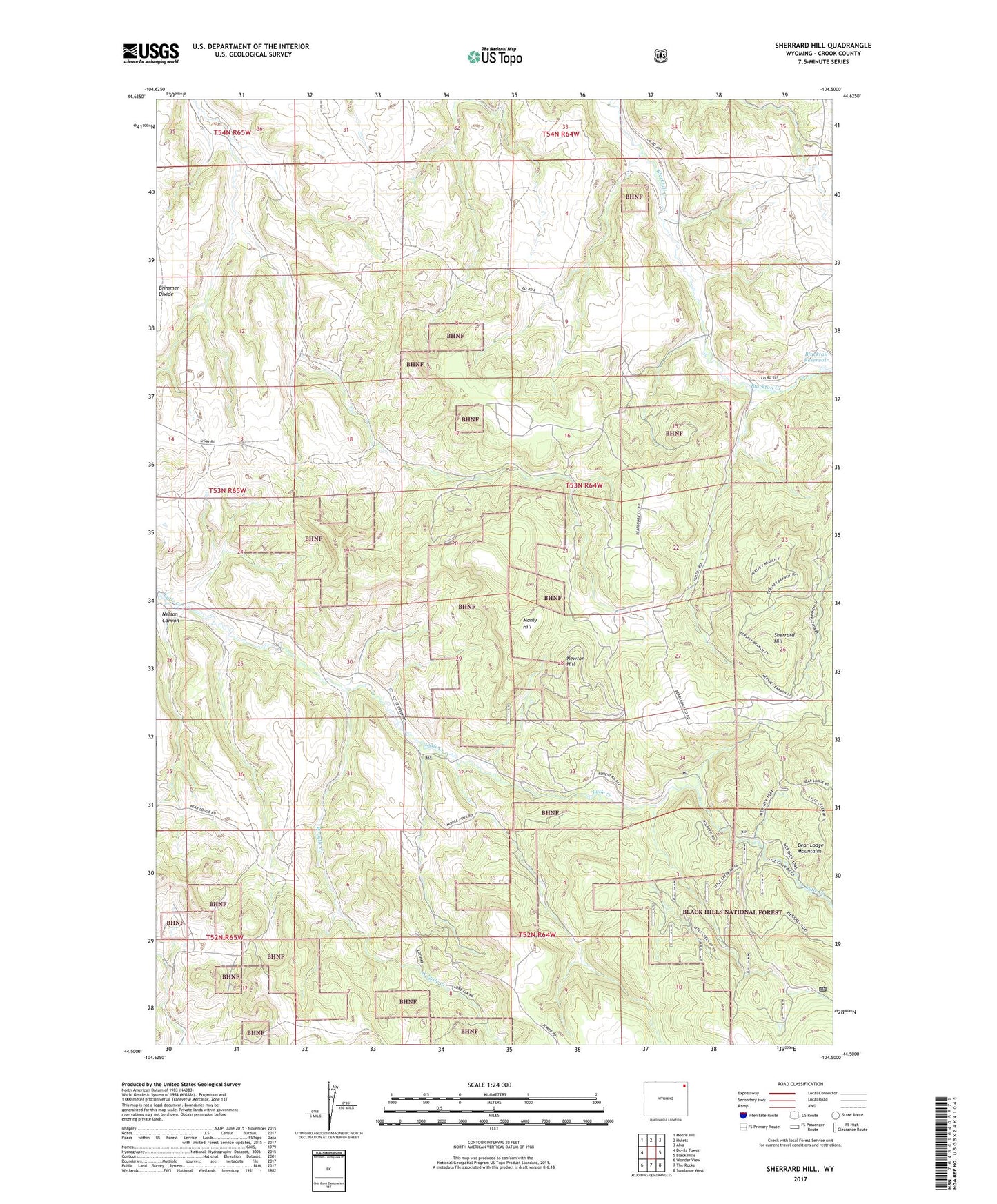
Sherrard Hill Wyoming US Topo Map
Couldn't load pickup availability
Also explore the Sherrard Hill Forest Service Topo of this same quad for updated USFS data
2021 topographic map quadrangle Sherrard Hill in the state of Wyoming. Scale: 1:24000. Based on the newly updated USGS 7.5' US Topo map series, this map is in the following counties: Crook. The map contains contour data, water features, and other items you are used to seeing on USGS maps, but also has updated roads and other features. This is the next generation of topographic maps. Printed on high-quality waterproof paper with UV fade-resistant inks.
Quads adjacent to this one:
West: Devils Tower
Northwest: Moore Hill
North: Hulett
Northeast: Alva
East: Black Hills
Southeast: Sundance West
South: The Rocks
Southwest: Wonder View
This map covers the same area as the classic USGS quad with code o44104e5.
Contains the following named places: Blacktail Dam, Blacktail Reservoir, Crook County, Forest School, Fort Ranch, Lytle Creek School, Manly Hill, Nelson Canyon, Newton Hill, Russell School, Sherrard Hill, West Lytle Creek