MyTopo
Riverview Wyoming US Topo Map
Couldn't load pickup availability
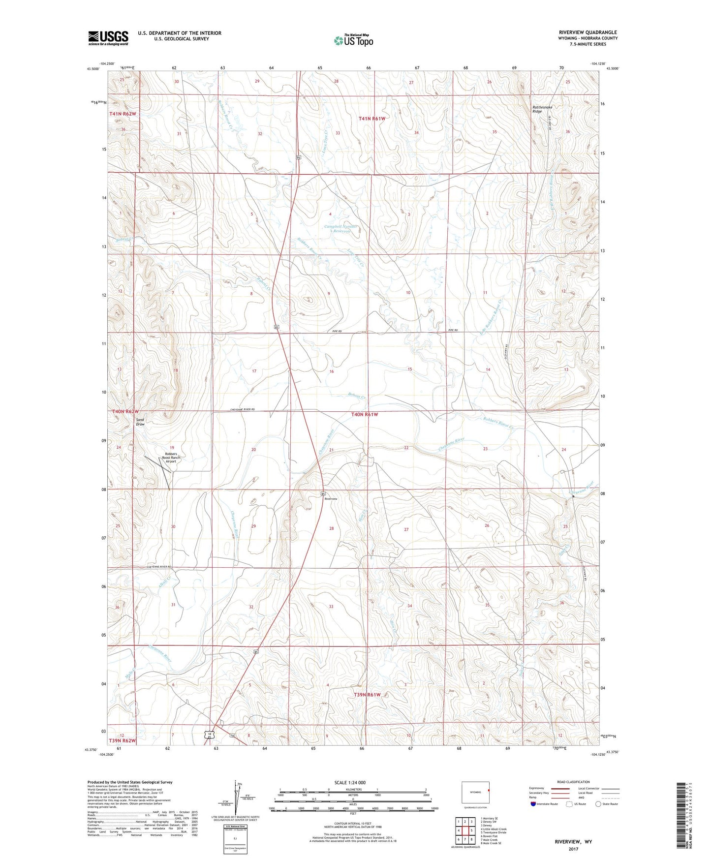
2021 topographic map quadrangle Riverview in the state of Wyoming. Scale: 1:24000. Based on the newly updated USGS 7.5' US Topo map series, this map is in the following counties: Niobrara. The map contains contour data, water features, and other items you are used to seeing on USGS maps, but also has updated roads and other features. This is the next generation of topographic maps. Printed on high-quality waterproof paper with UV fade-resistant inks.
Quads adjacent to this one:
West: Little Alkali Creek
Northwest: Morrisey SE
North: Dewey SW
Northeast: Dewey
Southeast: Mule Creek SE
South: Mule Creek
Southwest: Bowen Flat
This map covers the same area as the classic USGS quad with code o43104d2.
Contains the following named places: Aeberg Dam, Aeberg Reservoir, Alkali Creek, Bobcat Creek, Campbell Number 1 Dam, Campbell Number 1 Reservoir, Campbell Number 2 Dam, Campbell Number 2 Reservoir, Cheyenne River School, Dale Number 1 Dam, Dale Number 1 Reservoir, East Branch Robbers Roost Creek, Hon Creek, Lone Tree Creek, Mule Creek, Mule Creek Junction, Riverview, Robbers Roost Creek, Robbers Roost Ranch Airport, Robbers Roost Stage Station, Sage Creek, Sand Draw, Sedgwick Dam, Sedgwick Reservoir