
MyTopo
Dixon Wyoming US Topo Map
Couldn't load pickup availability
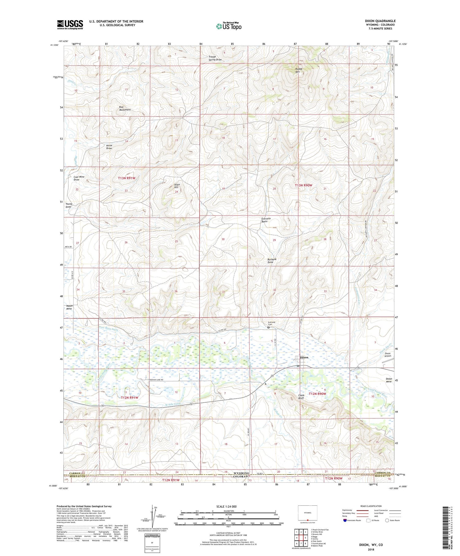
2021 topographic map quadrangle Dixon in the state of Wyoming. Scale: 1:24000. Based on the newly updated USGS 7.5' US Topo map series, this map is in the following counties: Carbon, Moffat. The map contains contour data, water features, and other items you are used to seeing on USGS maps, but also has updated roads and other features. This is the next generation of topographic maps. Printed on high-quality waterproof paper with UV fade-resistant inks.
Quads adjacent to this one:
West: Baggs
Northwest: Peach Orchard Flat
North: Smiley Draw
Northeast: Browns Hill
East: Savery
Southeast: Bakers Peak
South: Fortification NE
Southwest: Pole Gulch
Contains the following named places: Allen Hill, Burbank Draw, Chalk Bluff, Coal Gulch Opening Mine, Coal Mine Draw, Cottonwood Creek, Cut-off Gulch Opening Mine, Dixon, Dixon Post Office, Dutch Joe Creek, Eversole Basin, Eversole Cemetery, First Mesa Ditch, Hicox Draw, Muddy Mountain, Red Monument, Town of Dixon, Willow Creek, Young Draw, ZIP Code: 82323


