MyTopo
Baggs Wyoming US Topo Map
Couldn't load pickup availability
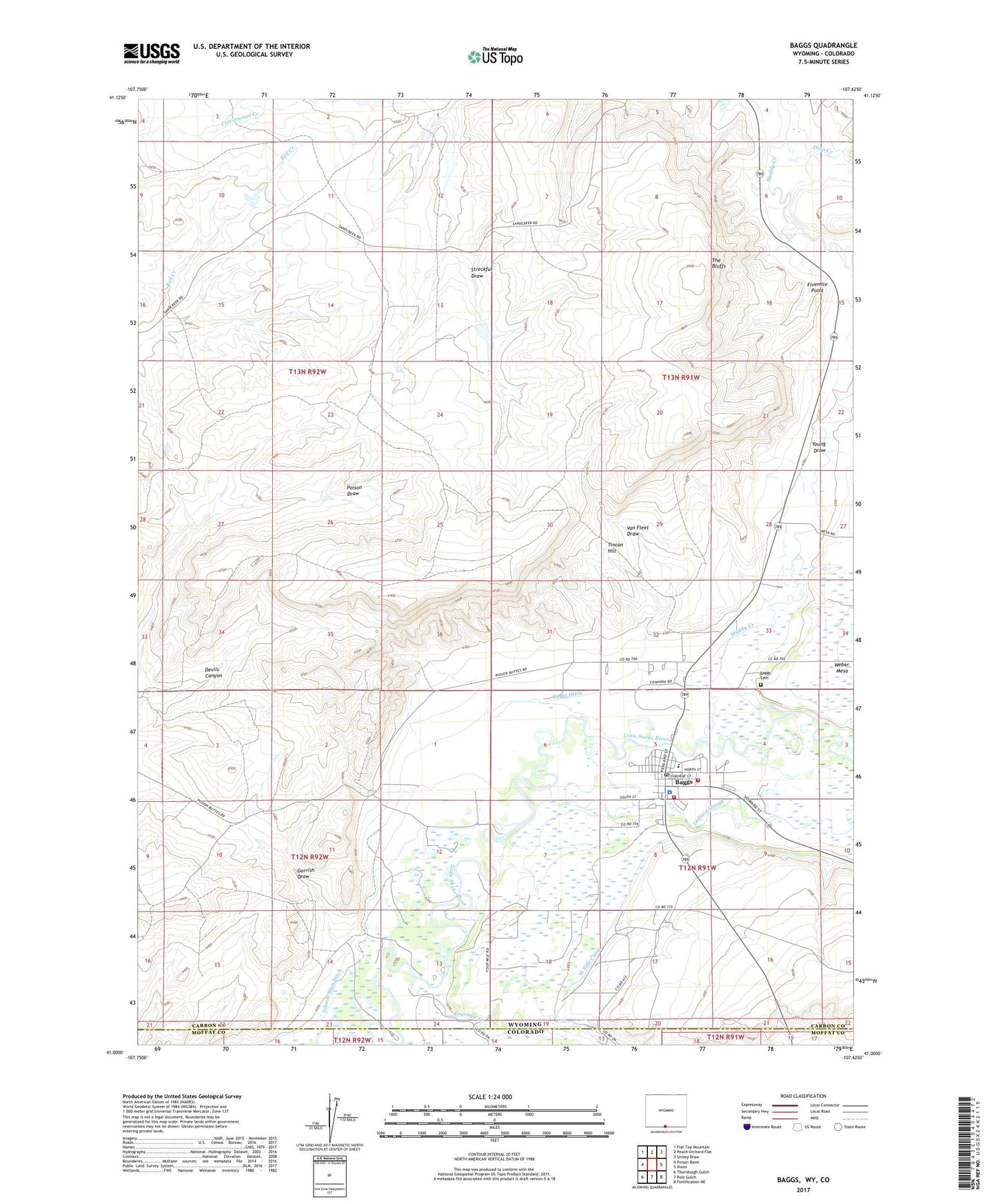
2021 topographic map quadrangle Baggs in the states of Wyoming, Colorado. Scale: 1:24000. Based on the newly updated USGS 7.5' US Topo map series, this map is in the following counties: Carbon, Moffat. The map contains contour data, water features, and other items you are used to seeing on USGS maps, but also has updated roads and other features. This is the next generation of topographic maps. Printed on high-quality waterproof paper with UV fade-resistant inks.
Quads adjacent to this one:
West: Poison Basin
Northwest: Flat Top Mountain
North: Peach Orchard Flat
Northeast: Smiley Draw
East: Dixon
Southeast: Fortification NE
South: Pole Gulch
Southwest: Thornburgh Gulch
This map covers the same area as the classic USGS quad with code o41107a6.
Contains the following named places: Baggs, Baggs Cemetery, Baggs Ditch, Baggs Post Office, Baggs Town Police Department, Baggs Volunteer Fire Department, Dead Horse Reservoir, Deep Creek, Detention Dam 1392 Number 2, Detention Dam 1392 Number 4, Devils Canyon, Fivemile Point, Fourmile Creek, Garrish Draw, Gibson Blair Ditch, Ledford Slough, Little Snake River Emergency Medical Services, Little Snake River Valley Elementary School, Little Snake River Valley High School, Muddy Creek, Streckfus Draw, The Bluffs, Tincan Hill, Town of Baggs, Van Fleet Draw, Weber Mesa, West Side Canal