MyTopo
Smiley Draw Wyoming US Topo Map
Couldn't load pickup availability
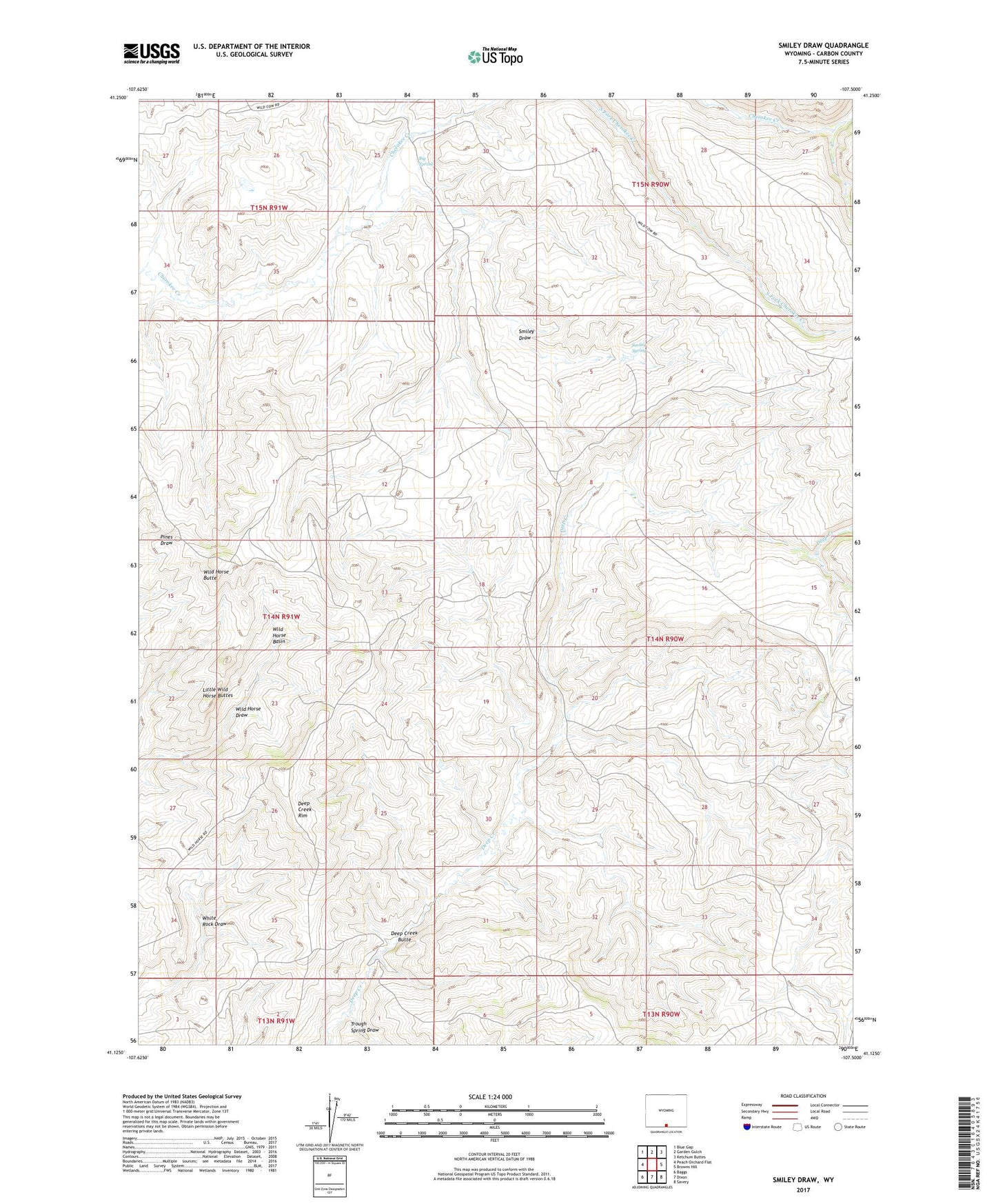
2021 topographic map quadrangle Smiley Draw in the state of Wyoming. Scale: 1:24000. Based on the newly updated USGS 7.5' US Topo map series, this map is in the following counties: Carbon. The map contains contour data, water features, and other items you are used to seeing on USGS maps, but also has updated roads and other features. This is the next generation of topographic maps. Printed on high-quality waterproof paper with UV fade-resistant inks.
Quads adjacent to this one:
West: Peach Orchard Flat
Northwest: Blue Gap
North: Garden Gulch
Northeast: Ketchum Buttes
East: Browns Hill
Southeast: Savery
South: Dixon
Southwest: Baggs
This map covers the same area as the classic USGS quad with code o41107b5.
Contains the following named places: Big Spring, Deep Creek Butte, Deep Creek Rim, Little Wild Horse Buttes, Morgan Ranch, Smiley Draw, Smiley Spring, Trough Spring Draw, Wild Horse Basin, Wild Horse Butte