MyTopo
Double L Ranch Wyoming US Topo Map
Couldn't load pickup availability
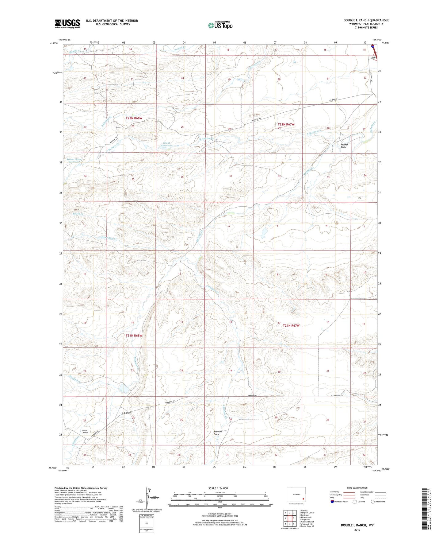
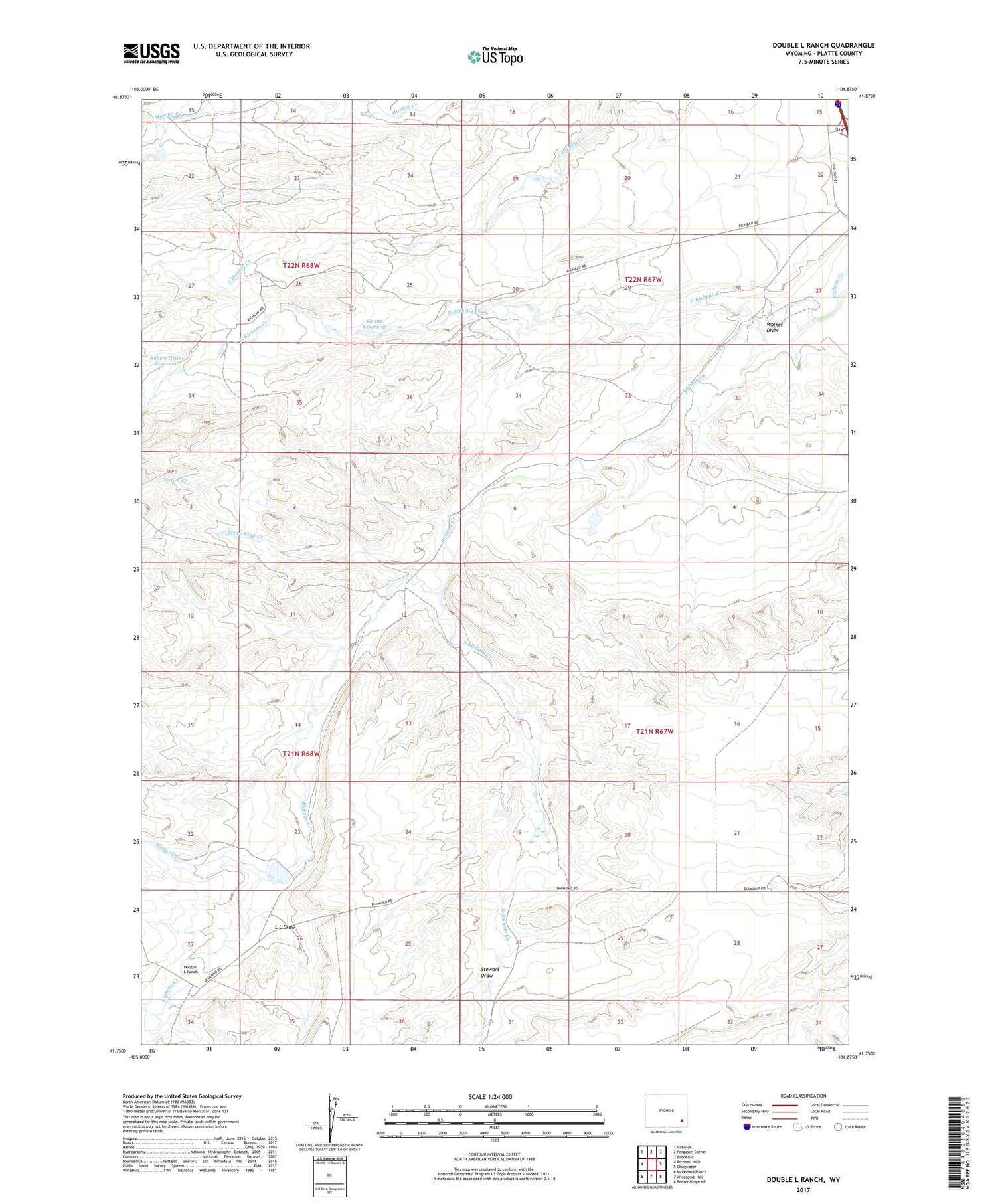
2021 topographic map quadrangle Double L Ranch in the state of Wyoming. Scale: 1:24000. Based on the newly updated USGS 7.5' US Topo map series, this map is in the following counties: Platte. The map contains contour data, water features, and other items you are used to seeing on USGS maps, but also has updated roads and other features. This is the next generation of topographic maps. Printed on high-quality waterproof paper with UV fade-resistant inks.
Quads adjacent to this one:
West: Richeau Hills
Northwest: Natwick
North: Ferguson Corner
Northeast: Bordeaux
East: Chugwater
Southeast: Bristol Ridge NE
South: Whitcomb Hill
Southwest: McDonald Ranch
Contains the following named places: Allison Ranch, Beacon Number 8, Chase Ranch, Chugwater Division, Double L Dam, Double L Ranch, Double L Reservoir, Grant Dam, Grant Ranch, Grant Reservoir, L L Draw, Lewis Ranch, Maxwell Creek, Mylet Ranch, North Richeau Creek, Robert Grant Dam, Robert Grant Reservoir, Ryff and Klassert Dam, Ryff and Klassert Reservoir, Scotch Creek, South Hunton Creek, South Richeau Creek, Stewart Draw, Tepee Ring Creek, Upper McDougal Ranch, Voight Ranch, Walker Draw