MyTopo
Bordeaux Wyoming US Topo Map
Couldn't load pickup availability
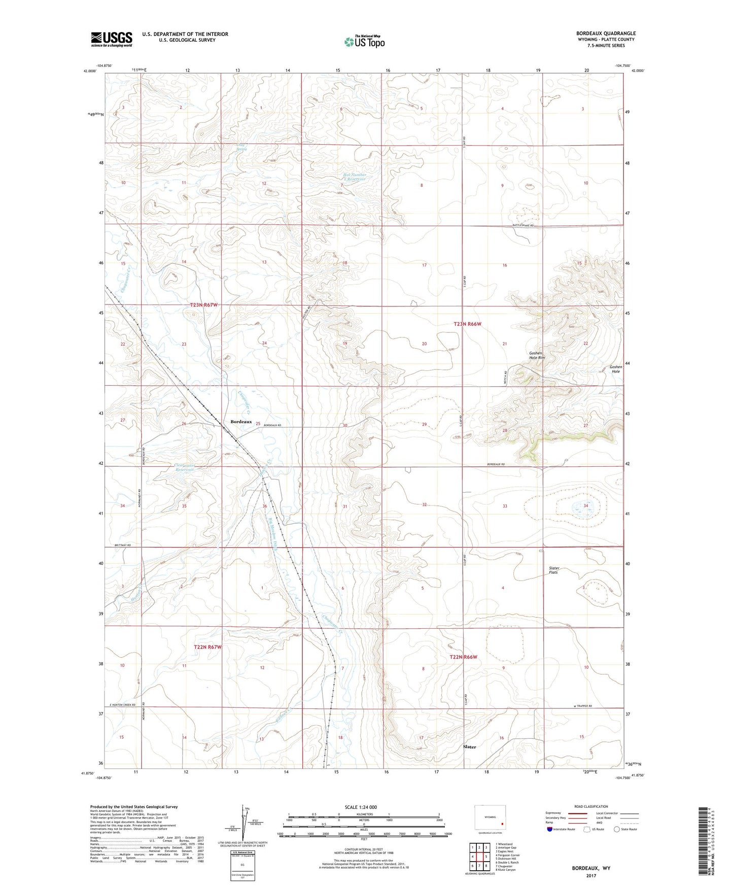
2021 topographic map quadrangle Bordeaux in the state of Wyoming. Scale: 1:24000. Based on the newly updated USGS 7.5' US Topo map series, this map is in the following counties: Platte. The map contains contour data, water features, and other items you are used to seeing on USGS maps, but also has updated roads and other features. This is the next generation of topographic maps. Printed on high-quality waterproof paper with UV fade-resistant inks.
Quads adjacent to this one:
West: Ferguson Corner
Northwest: Wheatland
North: Antelope Gap
Northeast: Eagles Nest
East: Dickinson Hill
Southeast: Klutz Canyon
South: Chugwater
Southwest: Double L Ranch
This map covers the same area as the classic USGS quad with code o41104h7.
Contains the following named places: Big Meadow Ditch, Bordeaux, Bordeaux Ditch, Chug Spring, Clearwater Dam, Clearwater Reservoir, Hal Dam, Hal Number 2 Dam, Hal Number 2 Reservoir, Hal Reservoir, Hunton Creek, Ken Number 1 Dam, Ken Number 1 Reservoir, L D Ranch, M Bar Ranch, Phillippi Ranch, Pump Dam, Pump Reservoir, Richeau Creek, Slater Census Designated Place, Slater Flats, Wedemeyer Ranch, Wyatt Number 2 Dam, Wyatt Reservoir Number 2