MyTopo
Ferguson Corner Wyoming US Topo Map
Couldn't load pickup availability
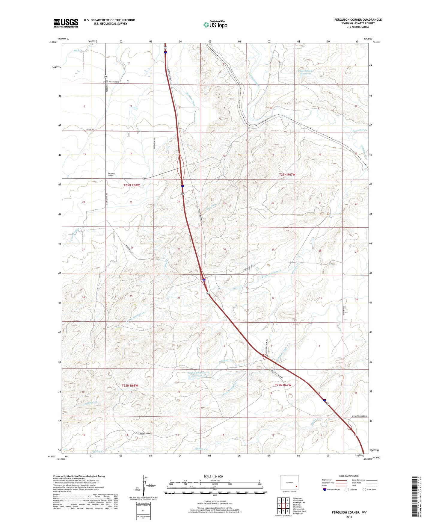
2021 topographic map quadrangle Ferguson Corner in the state of Wyoming. Scale: 1:24000. Based on the newly updated USGS 7.5' US Topo map series, this map is in the following counties: Platte. The map contains contour data, water features, and other items you are used to seeing on USGS maps, but also has updated roads and other features. This is the next generation of topographic maps. Printed on high-quality waterproof paper with UV fade-resistant inks.
Quads adjacent to this one:
West: Natwick
Northwest: Hightower
North: Wheatland
Northeast: Antelope Gap
East: Bordeaux
Southeast: Chugwater
South: Double L Ranch
Southwest: Richeau Hills
This map covers the same area as the classic USGS quad with code o41104h8.
Contains the following named places: Antelope Creek, Bagley Brothers Dam, Bagley Brothers Reservoir, Bordeaux Canal, Chug Springs Dam, Chug Springs Reservoir, Dry Creek, Ferguson Corner, North Fork Antelope Creek, Richeau School, South Fork Antelope Creek