MyTopo
Eightmile Lake Wyoming US Topo Map
Couldn't load pickup availability
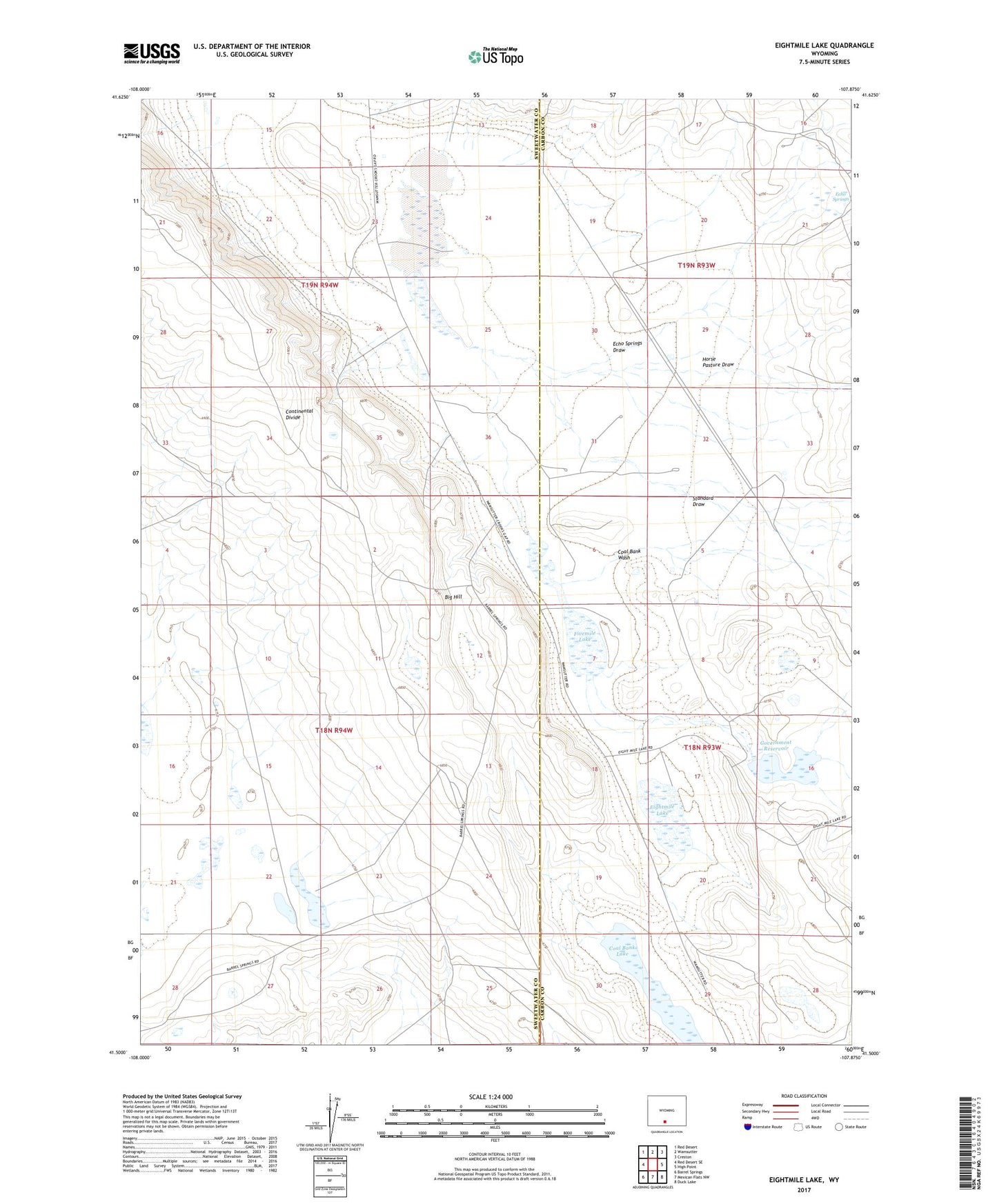
2021 topographic map quadrangle Eightmile Lake in the state of Wyoming. Scale: 1:24000. Based on the newly updated USGS 7.5' US Topo map series, this map is in the following counties: Sweetwater, Carbon. The map contains contour data, water features, and other items you are used to seeing on USGS maps, but also has updated roads and other features. This is the next generation of topographic maps. Printed on high-quality waterproof paper with UV fade-resistant inks.
Quads adjacent to this one:
West: Red Desert SE
Northwest: Red Desert
North: Wamsutter
Northeast: Creston
East: High Point
Southeast: Duck Lake
South: Mexican Flats NW
Southwest: Barrel Springs
This map covers the same area as the classic USGS quad with code o41107e8.
Contains the following named places: Coal Bank Lake, Coal Bank Wash, Dry Lake, Echo Springs, Echo Springs Draw, Eightmile Lake, Fivemile Lake, Government Number 1 Reservoir Dam, Government Reservoir, Horse Pasture Draw, Standard Draw