MyTopo
Wamsutter Wyoming US Topo Map
Couldn't load pickup availability
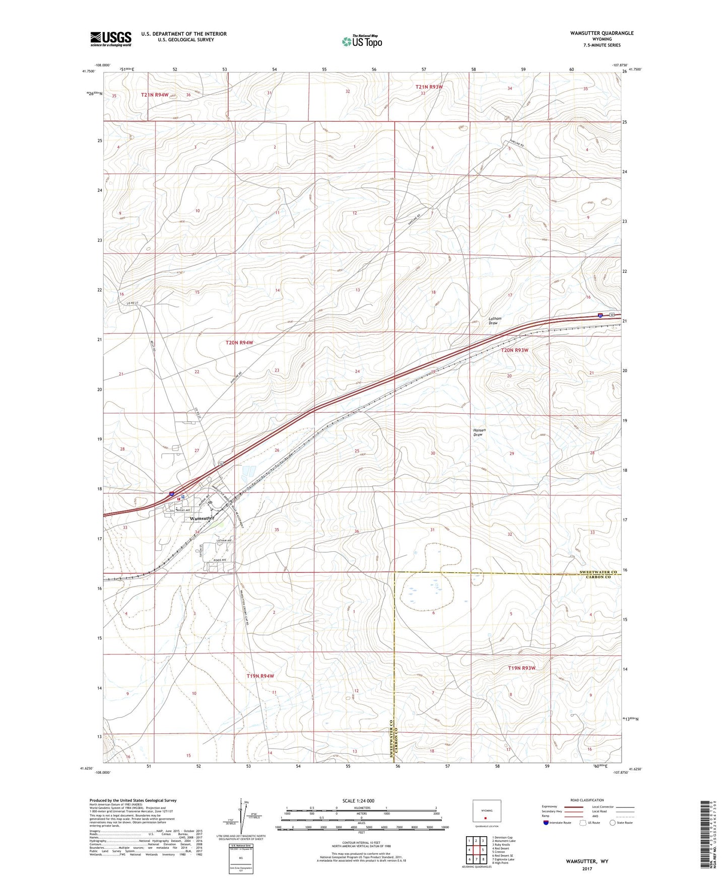
2021 topographic map quadrangle Wamsutter in the state of Wyoming. Scale: 1:24000. Based on the newly updated USGS 7.5' US Topo map series, this map is in the following counties: Sweetwater, Carbon. The map contains contour data, water features, and other items you are used to seeing on USGS maps, but also has updated roads and other features. This is the next generation of topographic maps. Printed on high-quality waterproof paper with UV fade-resistant inks.
Quads adjacent to this one:
West: Red Desert
Northwest: Dennison Cap
North: Monument Lake
Northeast: Ruby Knolls
East: Creston
Southeast: High Point
South: Eightmile Lake
Southwest: Red Desert SE
This map covers the same area as the classic USGS quad with code o41107f8.
Contains the following named places: Desert Middle School, Desert School, Hansen Draw, Sweetwater County Sheriff's Office Wamsutter, Sweetwater Uranium Mine, Town of Wamsutter, Wamsutter, Wamsutter Police Department, Wamsutter Post Office, Wamsutter Volunteer Fire Department