MyTopo
Fort Bridger Wyoming US Topo Map
Couldn't load pickup availability
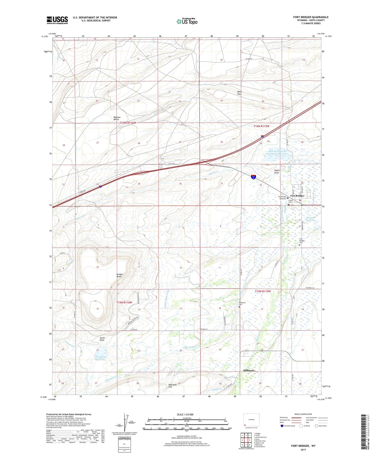
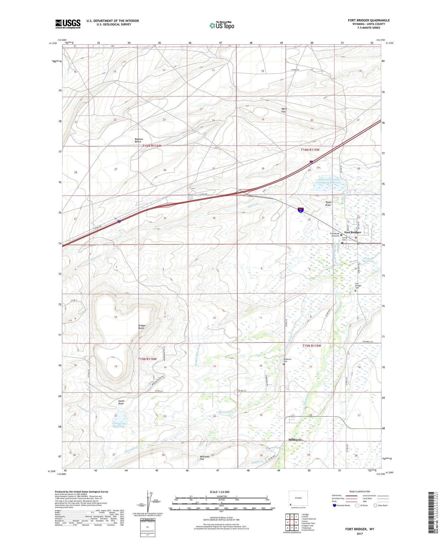
2021 topographic map quadrangle Fort Bridger in the state of Wyoming. Scale: 1:24000. Based on the newly updated USGS 7.5' US Topo map series, this map is in the following counties: Uinta. The map contains contour data, water features, and other items you are used to seeing on USGS maps, but also has updated roads and other features. This is the next generation of topographic maps. Printed on high-quality waterproof paper with UV fade-resistant inks.
Quads adjacent to this one:
West: Leroy
Northwest: Bridger
North: Carter
Northeast: Austin Reservoir
East: Mountain View
Southeast: Leavitt Bench
South: Robertson
Southwest: Hague Creek
Contains the following named places: Bridger Butte, Bridger Butte Canal, Carter Cemetery, Center Ditch, Cottonwood Creek, Cottonwood Dam, Cottonwood Reservoir, Erickson Dam and Reservoir, Erickson Reservoir, Fort Bridger, Fort Bridger Cemetery, Fort Bridger Census Designated Place, Fort Bridger Post Office, Groshon Creek, Little Blacks Fork, Millburne, Millburne Cemetery, Pine Grove Canal, Quarry Creek, Sixmile Creek, South Draw, Taylor Draw, Thornburgh Gravesite, Threemile Creek, Uinta County Fire Protection Fort Bridger, Wall Reservoir, Wall Reservoir Dam, Wells Flat, ZIP Code: 82933