MyTopo
Mountain View Wyoming US Topo Map
Couldn't load pickup availability
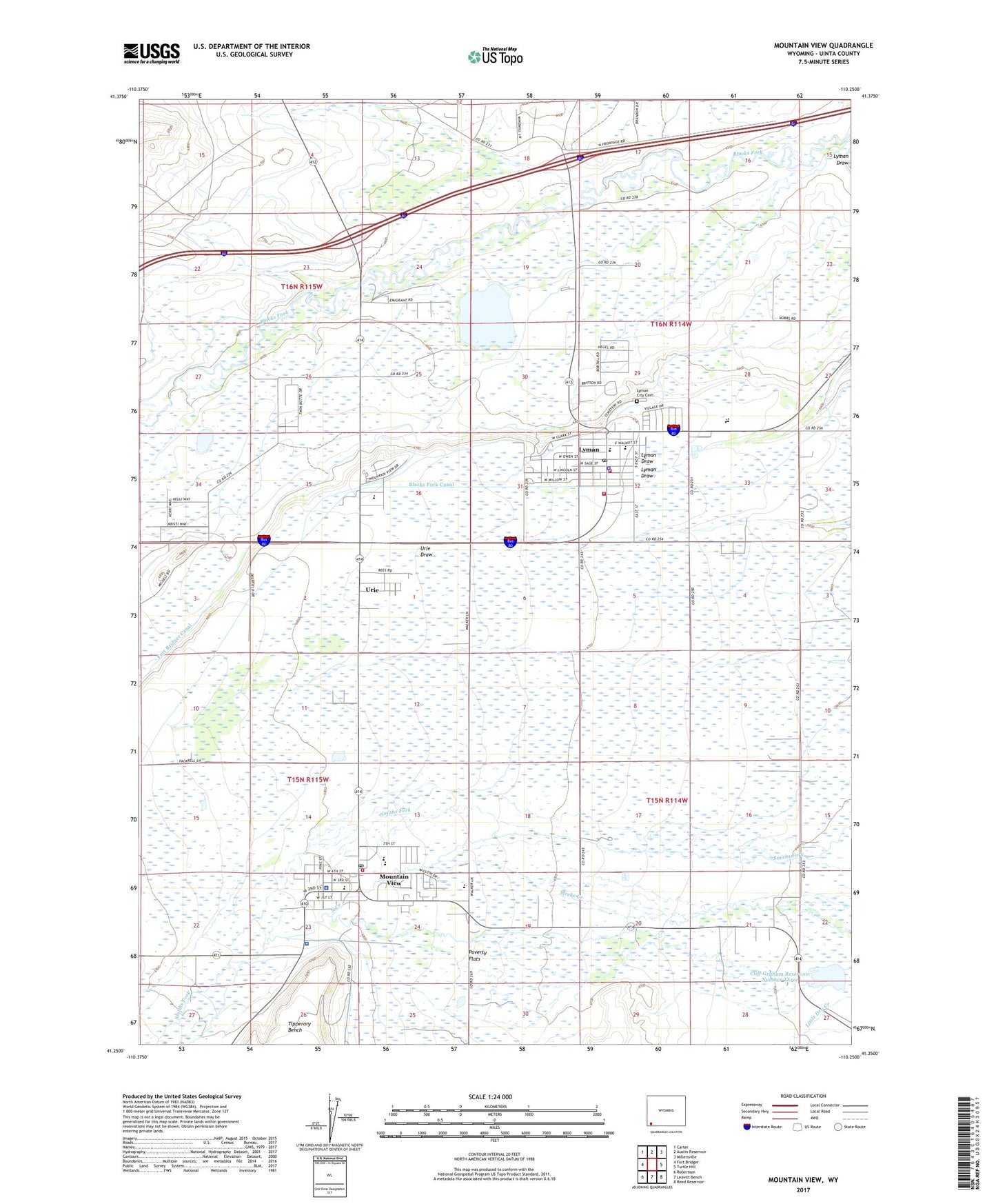
2021 topographic map quadrangle Mountain View in the state of Wyoming. Scale: 1:24000. Based on the newly updated USGS 7.5' US Topo map series, this map is in the following counties: Uinta. The map contains contour data, water features, and other items you are used to seeing on USGS maps, but also has updated roads and other features. This is the next generation of topographic maps. Printed on high-quality waterproof paper with UV fade-resistant inks.
Quads adjacent to this one:
West: Fort Bridger
Northwest: Carter
North: Austin Reservoir
Northeast: Millersville
East: Turtle Hill
Southeast: Reed Reservoir
South: Leavitt Bench
Southwest: Robertson
This map covers the same area as the classic USGS quad with code o41110c3.
Contains the following named places: Blacks Fork Canal, Bridger Valley Division, Cliff Graham Reservoir Number Three, Clifford F Graham Dam, Fort Bridger Canal, Fort Bridger School, KBVZ-FM (Fort Bridger), Lyman, Lyman City Cemetery, Lyman Draw, Lyman High School, Lyman Middle School, Lyman Police Department, Lyman Post Office, Lyman School, Meeks Creek, Mountain View, Mountain View Fire Department, Mountain View High School, Mountain View Middle School, Mountain View Police Department, Mountain View Post Office, Mountain View School, North Creek, Paterson Lake Dam, Smiths Fork, Town of Lyman, Town of Mountain View, Twin Buttes Canal, Uinta County Emergency Medical Services Lyman, Uinta County Fire Protection Lyman, Uinta County Sheriff's Office Mountain View, Urie, Urie Census Designated Place, Urie School, ZIP Code: 82937