MyTopo
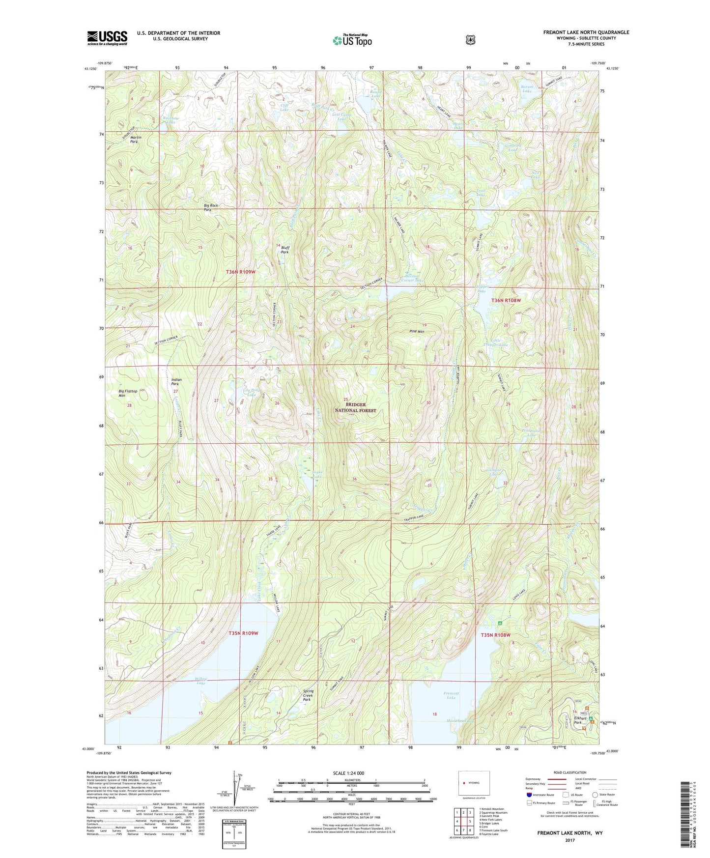
Fremont Lake North Wyoming US Topo Map
Couldn't load pickup availability
2021 topographic map quadrangle Fremont Lake North in the state of Wyoming. Scale: 1:24000. Based on the newly updated USGS 7.5' US Topo map series, this map is in the following counties: Sublette. The map contains contour data, water features, and other items you are used to seeing on USGS maps, but also has updated roads and other features. This is the next generation of topographic maps. Printed on high-quality waterproof paper with UV fade-resistant inks.
Quads adjacent to this one:
West: New Fork Lakes
Northwest: Kendall Mountain
North: Squaretop Mountain
Northeast: Gannett Peak
East: Bridger Lakes
Southeast: Fayette Lake
South: Fremont Lake South
Southwest: Cora
Contains the following named places: Big Flattop Mountain, Big Rock Park, Bluff Creek Trail, Bluff Park, Bluff Park Creek, Borum Lake, Bridger Creek, Cliff Lake, Crows Nest Lookout, Cumberland Creek, Elkhart Park, Faler Creek, Fremont Creek, Glimpse Lake, Glimpse Lake Trail, Gottfried Lake, Heart Lake, Indian Park, Lily Pond Lake, Little Trapper Lake, Long Lake Trail, Lost Camp Lake, Martin Park, Miller Creek, Moosehead Bay, Neil Lake, Pine Creek Canyon Trail, Pine Mountain, Prospector Lake, Rainbow Lake, Round Lake, Section Corner Lake, Section Corner Lake Trail, Snake Lake, Snake Lake Trail, Spring Creek Park, Trail Lake, Trails End Campground, Trapper Creek, Trapper Lake, Trapper Lake Stock Trail, Upper Fremont Lake Campground, Willow Creek Lookout, Willow Lake, Willow Lake Trail