MyTopo
Cora Wyoming US Topo Map
Couldn't load pickup availability
Also explore the Cora Forest Service Topo of this same quad for updated USFS data
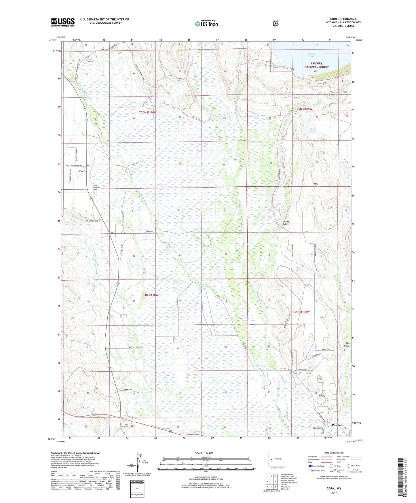
2021 topographic map quadrangle Cora in the state of Wyoming. Scale: 1:24000. Based on the newly updated USGS 7.5' US Topo map series, this map is in the following counties: Sublette. The map contains contour data, water features, and other items you are used to seeing on USGS maps, but also has updated roads and other features. This is the next generation of topographic maps. Printed on high-quality waterproof paper with UV fade-resistant inks.
Quads adjacent to this one:
West: Daniel Junction
Northwest: Warren Bridge
North: New Fork Lakes
Northeast: Fremont Lake North
East: Fremont Lake South
Southeast: Pinedale
South: Mount Airy
Southwest: Daniel
This map covers the same area as the classic USGS quad with code o42109h8.
Contains the following named places: Bar Cross Ranch, Binning Ditch, Binning Ranch, Chain Lakes, Cora, Cora Census Designated Place, Cora Pit, Cora Post Office, F Bar Cross Seventy-six Mine, Faler Creek, Freds Hill Pit, Graveyard Pit, Hay Gulch, Highline Ditch, Indian Graves, Jenkins Ditch, Lake Creek, Noble Pit, Rahm Ditch, Spring Gulch, Trappers Point Historical Monument, Westfall - Cora Cemetery, Willow Creek, Willow Lake Campground, Willow Lake Dam, Wimple Pit