MyTopo
Fremont Peak South Wyoming US Topo Map
Couldn't load pickup availability
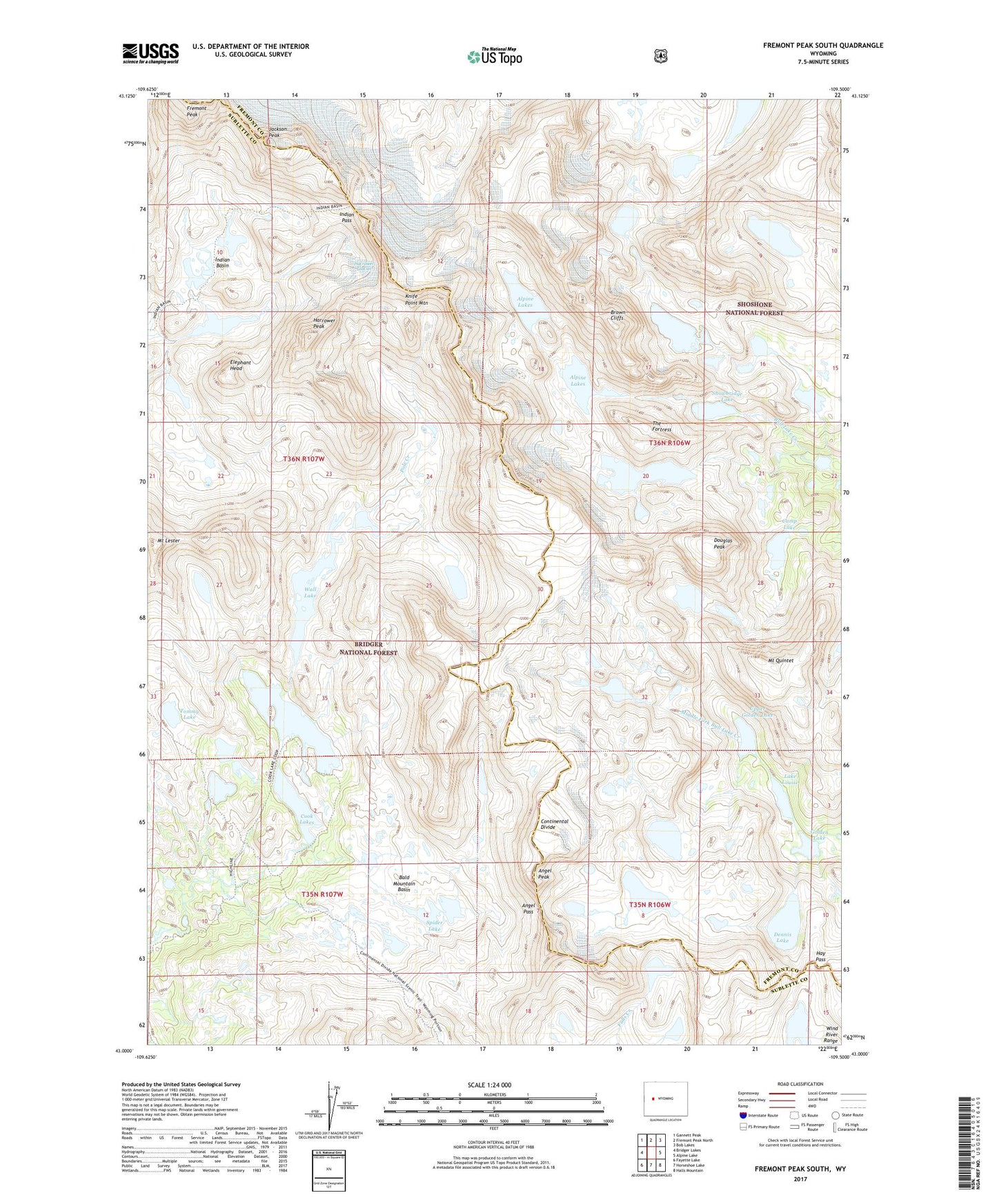
2021 topographic map quadrangle Fremont Peak South in the state of Wyoming. Scale: 1:24000. Based on the newly updated USGS 7.5' US Topo map series, this map is in the following counties: Fremont, Sublette. The map contains contour data, water features, and other items you are used to seeing on USGS maps, but also has updated roads and other features. This is the next generation of topographic maps. Printed on high-quality waterproof paper with UV fade-resistant inks.
Quads adjacent to this one:
West: Bridger Lakes
Northwest: Gannett Peak
North: Fremont Peak North
Northeast: Bob Lakes
East: Alpine Lake
Southeast: Halls Mountain
South: Horseshoe Lake
Southwest: Fayette Lake
Contains the following named places: Alpine Lakes, Angel Pass, Angel Peak, Bald Mountain Basin, Brown Cliffs, Bull Lake Glacier, Camp Lake, Cook Lake Trail, Cook Lakes, Dennis Lake, Douglas Peak, Elephant Head, Fremont Peak, Golden Lake, Harrower Glacier, Harrower Peak, Hay Pass, Indian Basin, Indian Pass, Jackson Peak, Knife Point Glacier, Knife Point Mountain, Lake Louise, Mount Lester, Mount Quintet, Snowbridge Lake, Spider Lake, The Fortress, Tiny Glacier, Tommy Lake, Upper Golden Lake, Wall Lake