MyTopo
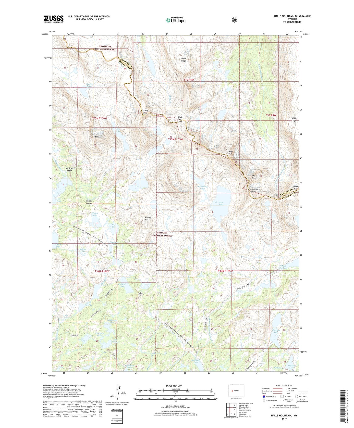
Halls Mountain Wyoming US Topo Map
Couldn't load pickup availability
Also explore the Halls Mountain Forest Service Topo of this same quad for updated USFS data
2021 topographic map quadrangle Halls Mountain in the state of Wyoming. Scale: 1:24000. Based on the newly updated USGS 7.5' US Topo map series, this map is in the following counties: Sublette, Fremont. The map contains contour data, water features, and other items you are used to seeing on USGS maps, but also has updated roads and other features. This is the next generation of topographic maps. Printed on high-quality waterproof paper with UV fade-resistant inks.
Quads adjacent to this one:
West: Horseshoe Lake
Northwest: Fremont Peak South
North: Alpine Lake
Northeast: Paradise Basin
East: Roberts Mountain
Southeast: Mount Bonneville
South: Raid Lake
Southwest: Scab Creek
This map covers the same area as the classic USGS quad with code o42109h4.
Contains the following named places: Europe Canyon, Europe Canyon Trail, Europe Peak, Fire Hole Lakes, Firehole Trail, Glacier Lake, Halls Butte, Halls Lake, Halls Lake Trail, Halls Mountain, Howard Lake, Lake Isabella, Lake Isabella Trail, Lake Prue, Lake Susan, Lake Vera, Lake Victor, Long Lake, Medina Lake, Medina Mountain, Middle Fork Trail, Milky Ridge, Mount Victor, Photo Pass, Pipe Organ, Pipestone Lakes, Rainbow Lake, Sandpoint Lake, Shoestring Lake, Sunrise Lake, Valley Lake, Wilderness Lake