
MyTopo
Gardner Gulch Wyoming US Topo Map
Couldn't load pickup availability
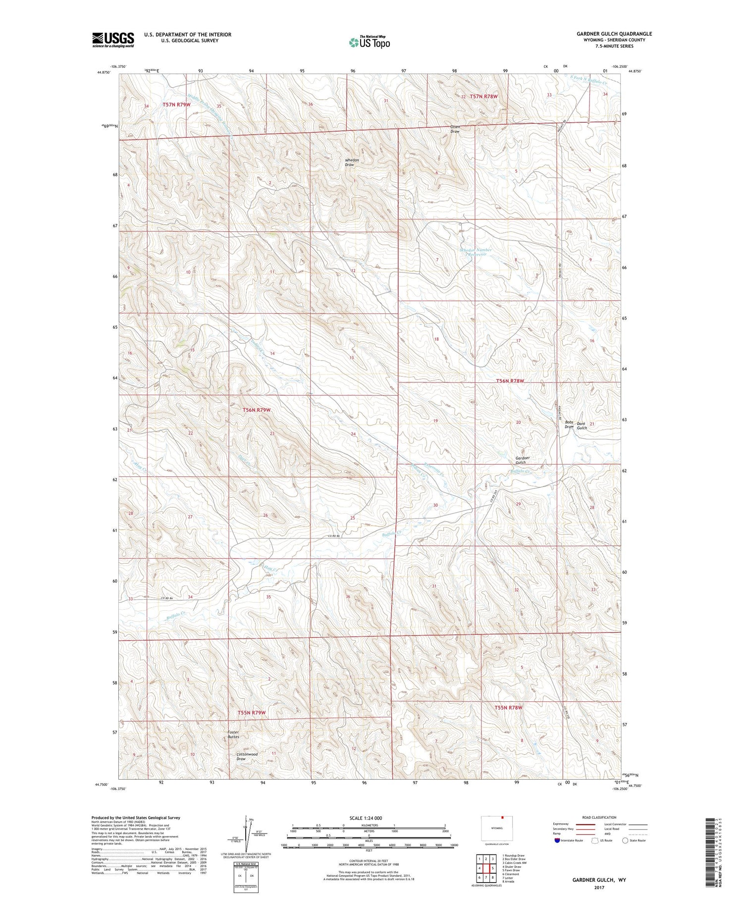
2021 topographic map quadrangle Gardner Gulch in the state of Wyoming. Scale: 1:24000. Based on the newly updated USGS 7.5' US Topo map series, this map is in the following counties: Sheridan. The map contains contour data, water features, and other items you are used to seeing on USGS maps, but also has updated roads and other features. This is the next generation of topographic maps. Printed on high-quality waterproof paper with UV fade-resistant inks.
Quads adjacent to this one:
West: Shuler Draw
Northwest: Roundup Draw
North: Box Elder Draw
Northeast: Cabin Creek NW
East: Fawn Draw
Southeast: Arvada
South: Leiter
Southwest: Clearmont
Contains the following named places: Bobs Draw, Dans Gulch, Deer Creek, Foster Buttes, Gardner Gulch, Griffith Dam, Griffith Reservoir, Hay Creek, Indian Creek, Reservoir Creek, Whedon Dam, Whedon Number 1 Reservoir, ZIP Code: 82835


