MyTopo
Leiter Wyoming US Topo Map
Couldn't load pickup availability
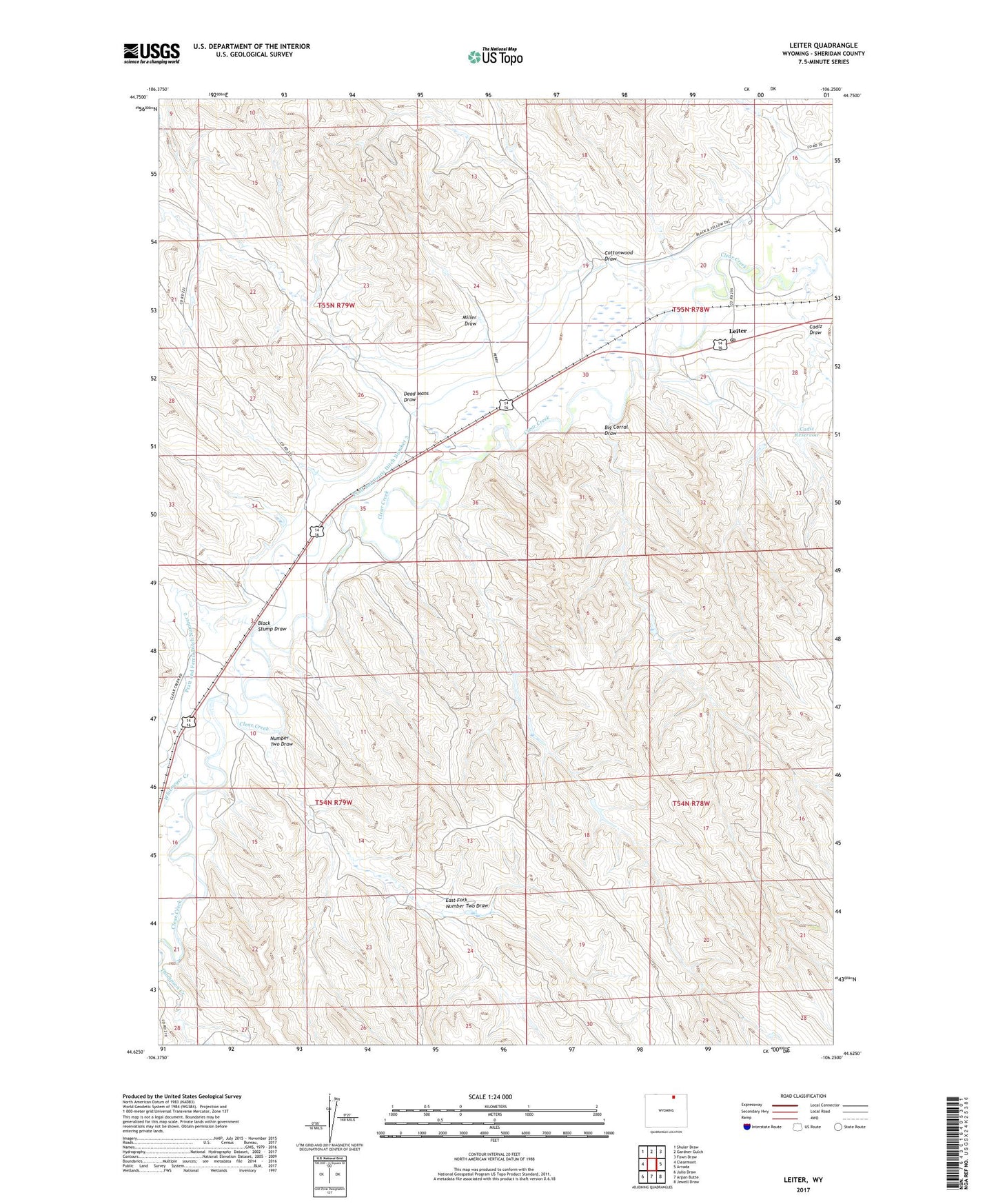
2021 topographic map quadrangle Leiter in the state of Wyoming. Scale: 1:24000. Based on the newly updated USGS 7.5' US Topo map series, this map is in the following counties: Sheridan. The map contains contour data, water features, and other items you are used to seeing on USGS maps, but also has updated roads and other features. This is the next generation of topographic maps. Printed on high-quality waterproof paper with UV fade-resistant inks.
Quads adjacent to this one:
West: Clearmont
Northwest: Shuler Draw
North: Gardner Gulch
Northeast: Fawn Draw
East: Arvada
Southeast: Jewell Draw
South: Arpan Butte
Southwest: Julio Draw
This map covers the same area as the classic USGS quad with code o44106f3.
Contains the following named places: Auzoui Number 1 Dam, Auzqui Number 1 Reservoir, Big Corral, Big Corral Draw, Black Stump Draw, Busted Clutch Dam, Busted Clutch Reservoir, Cadiz Dam, Cadiz Draw, Cadiz Reservoir, Corrals Dam, Corrals Reservoir, Cottonwood Draw, Dead Mans Draw, Dick Number 1 Dam, Dick Reservoir Number 1, East Fork Number Two Draw, Leiter, Leiter Dam, Leiter Post Office, Leiter Reservoir, Miller Draw, Number Two Draw, Ollie Dam, Ollie Reservoir, Pollard Number 1 Dam, Pollard Reservoir Number 1, Pratt and Ferris Ditch Number 2, Pratt and Ferris Ditch Number 3, Whitmeyer Creek