MyTopo
Shuler Draw Wyoming US Topo Map
Couldn't load pickup availability
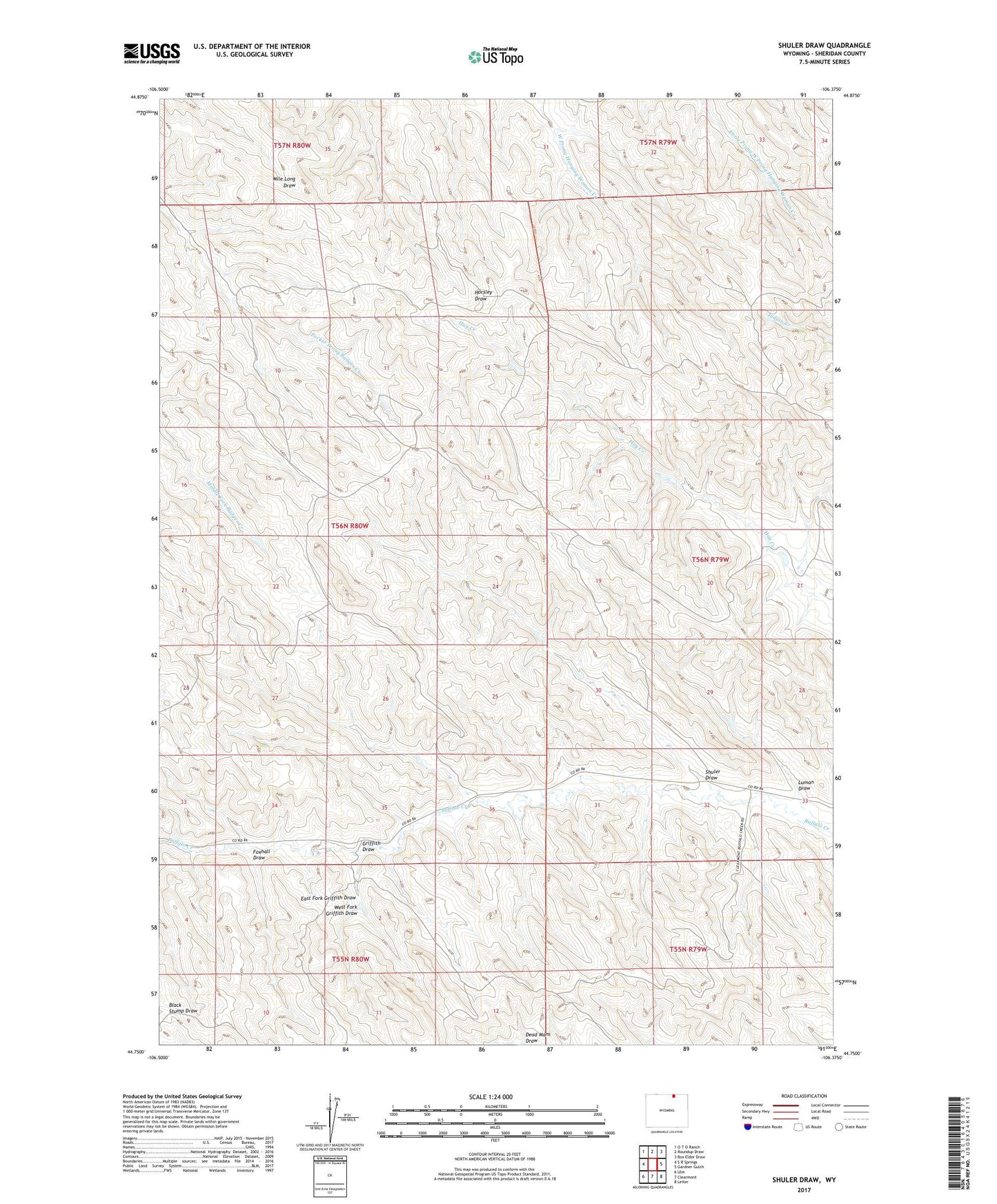
2021 topographic map quadrangle Shuler Draw in the state of Wyoming. Scale: 1:24000. Based on the newly updated USGS 7.5' US Topo map series, this map is in the following counties: Sheridan. The map contains contour data, water features, and other items you are used to seeing on USGS maps, but also has updated roads and other features. This is the next generation of topographic maps. Printed on high-quality waterproof paper with UV fade-resistant inks.
Quads adjacent to this one:
West: S R Springs
Northwest: O T O Ranch
North: Roundup Draw
Northeast: Box Elder Draw
East: Gardner Gulch
Southeast: Leiter
South: Clearmont
Southwest: Ulm
This map covers the same area as the classic USGS quad with code o44106g4.
Contains the following named places: East Fork Griffith Draw, Foxhall Draw, Griffith Dam, Griffith Draw, Luman Draw, Roberts Luman Draw Dam, Roberts Luman Draw Reservoir, Sheridan Division, Shuler Draw, West Fork Griffith Draw