MyTopo
Greybull South Wyoming US Topo Map
Couldn't load pickup availability
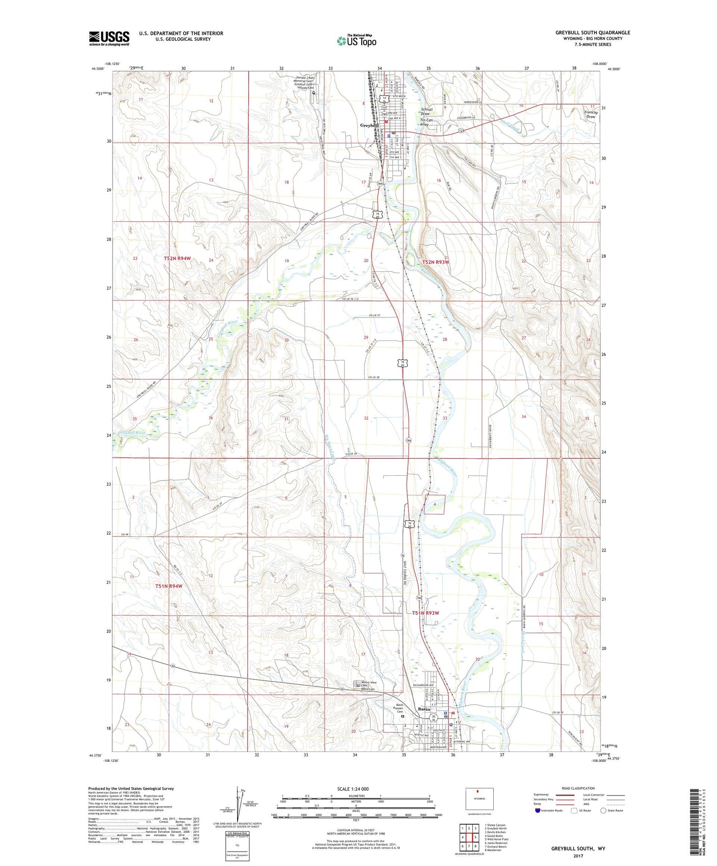
2021 topographic map quadrangle Greybull South in the state of Wyoming. Scale: 1:24000. Based on the newly updated USGS 7.5' US Topo map series, this map is in the following counties: Big Horn. The map contains contour data, water features, and other items you are used to seeing on USGS maps, but also has updated roads and other features. This is the next generation of topographic maps. Printed on high-quality waterproof paper with UV fade-resistant inks.
Quads adjacent to this one:
West: Gould Butte
Northwest: Sheep Canyon
North: Greybull North
Northeast: Devils Kitchen
East: Wild Horse Flats
Southeast: Manderson
South: Orchard Bench
Southwest: Jones Reservoir
This map covers the same area as the classic USGS quad with code o44108d1.
Contains the following named places: Atwood's Family Ambulance, Basin, Basin Pioneer Cemetery, Basin Police Department, Basin Post Office, Basin Volunteer Fire Department, Beaver Hill Mines, Big Horn County Sheriff's Office, Big Horn Redi-Mix Incorporated Mine, Bonnie Bluejacket Nursing Home, Donald J Ruhl Memorial Cemetery, Dresser Bentonite Clay Mine, Greybull, Greybull Elementary School, Greybull Emergency Medical Services, Greybull High School, Greybull Middle School, Greybull Mine, Greybull Police Department, Greybull Post Office, Greybull River, Greybull Volunteer Fire Department, KZMQ-AM (Greybull), Laura Irwin Elementary School, Mount View Cemetery, Riverside Middle - High School, Schroll Draw, South Big Horn County Critical Access Hospital, Tilard Canal, Tin Can Alley, Town of Basin, Town of Greybull, Wyoming Retirement Center