MyTopo
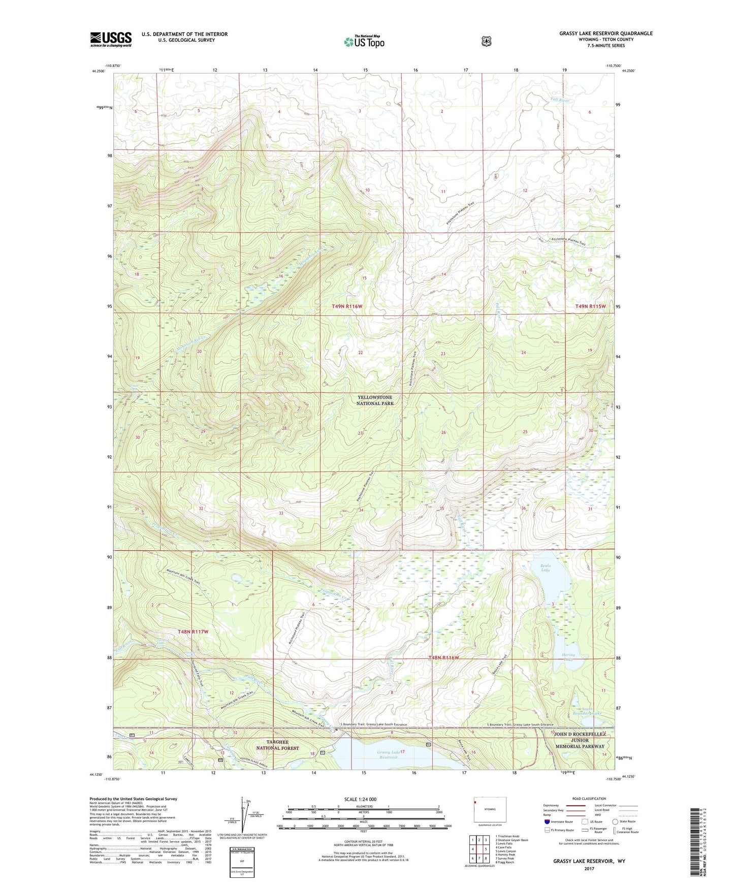
Grassy Lake Reservoir Wyoming US Topo Map
Couldn't load pickup availability
Also explore the Grassy Lake Reservoir Forest Service Topo of this same quad for updated USFS data
2021 topographic map quadrangle Grassy Lake Reservoir in the state of Wyoming. Scale: 1:24000. Based on the newly updated USGS 7.5' US Topo map series, this map is in the following counties: Teton. The map contains contour data, water features, and other items you are used to seeing on USGS maps, but also has updated roads and other features. This is the next generation of topographic maps. Printed on high-quality waterproof paper with UV fade-resistant inks.
Quads adjacent to this one:
West: Cave Falls
Northwest: Trischman Knob
North: Shoshone Geyser Basin
Northeast: Lewis Falls
East: Lewis Canyon
Southeast: Flagg Ranch
South: Survey Peak
Southwest: Hominy Peak
This map covers the same area as the classic USGS quad with code o44110b7.
Contains the following named places: Beula Lake, Beula Lake Trail, Cascade Acres, Cascade Creek, Grassy Lake Dam, Grassy Lake Reservoir, Hering Lake, Pitchstone Plateau Trail, South Boundary Lake, Terraced Falls, Union Falls