MyTopo
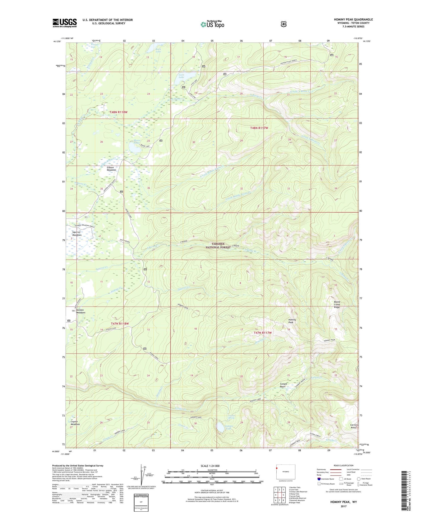
Hominy Peak Wyoming US Topo Map
Couldn't load pickup availability
Also explore the Hominy Peak Forest Service Topo of this same quad for updated USFS data
2021 topographic map quadrangle Hominy Peak in the state of Wyoming. Scale: 1:24000. Based on the newly updated USGS 7.5' US Topo map series, this map is in the following counties: Teton. The map contains contour data, water features, and other items you are used to seeing on USGS maps, but also has updated roads and other features. This is the next generation of topographic maps. Printed on high-quality waterproof paper with UV fade-resistant inks.
Quads adjacent to this one:
West: Sheep Falls
Northwest: Bechler Falls
North: Cave Falls
Northeast: Grassy Lake Reservoir
East: Survey Peak
Southeast: Ranger Peak
South: Rammell Mountain
Southwest: McRenolds Reservoir
This map covers the same area as the classic USGS quad with code o44110a8.
Contains the following named places: Boone Creek Ridge, Carrot Knoll, Conant Basin, Crystal Spring, Gibson Meadows, Hidden Lake, Hominy Creek, Hominy Peak, Jackass Meadows, Loon Lake, Lucky Lady Mine, Moose Lake, North Fork Middle Boone Creek, North Fork North Boone Creek, North Fork South Boone Creek, Porter Ranch, Rock Lake, South Boone Creek, South Fork Middle Boone Creek, South Fork North Boone Creek, Winegar Hole, Winegar Hole Wilderness