MyTopo
Halfway Hollow West Wyoming US Topo Map
Couldn't load pickup availability
Also explore the Halfway Hollow West Forest Service Topo of this same quad for updated USFS data
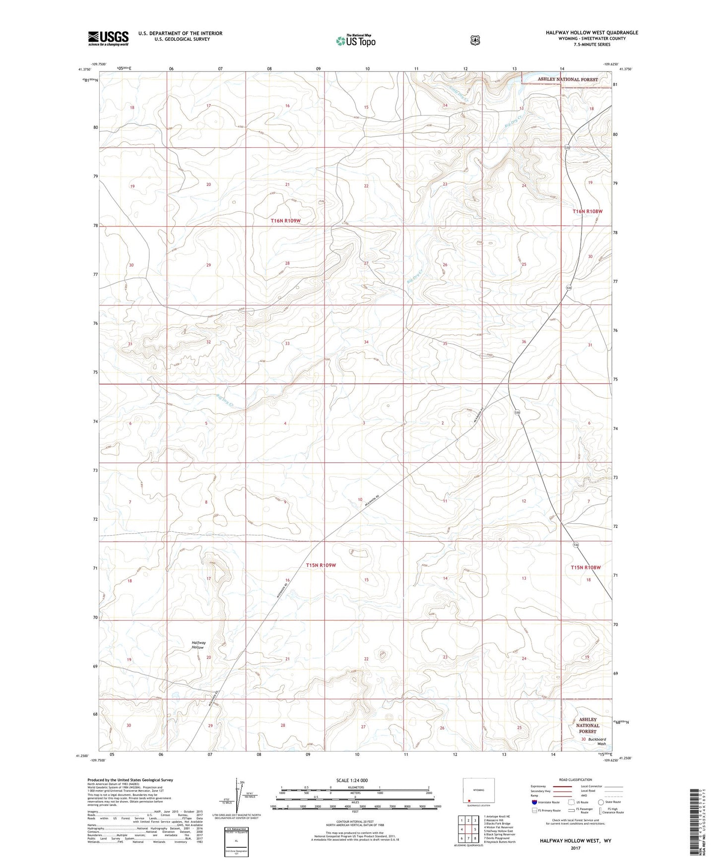
2021 topographic map quadrangle Halfway Hollow West in the state of Wyoming. Scale: 1:24000. Based on the newly updated USGS 7.5' US Topo map series, this map is in the following counties: Sweetwater. The map contains contour data, water features, and other items you are used to seeing on USGS maps, but also has updated roads and other features. This is the next generation of topographic maps. Printed on high-quality waterproof paper with UV fade-resistant inks.
Quads adjacent to this one:
West: Winter Fat Reservoir
Northwest: Antelope Knoll NE
North: Massacre Hill
Northeast: Blacks Fork Bridge
East: Halfway Hollow East
Southeast: Haystack Buttes North
South: Devils Playground
Southwest: Black Spring Reservoir
This map covers the same area as the classic USGS quad with code o41109c6.
Contains the following named places: Little Dry Creek, McKinnon Junction