MyTopo
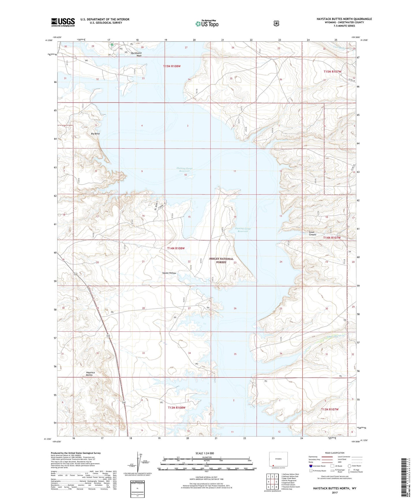
Haystack Buttes North Wyoming US Topo Map
Couldn't load pickup availability
Also explore the Haystack Buttes North Forest Service Topo of this same quad for updated USFS data
2023 topographic map quadrangle Haystack Buttes North in the state of Wyoming. Scale: 1:24000. Based on the newly updated USGS 7.5' US Topo map series, this map is in the following counties: Sweetwater. The map contains contour data, water features, and other items you are used to seeing on USGS maps, but also has updated roads and other features. This is the next generation of topographic maps. Printed on high-quality waterproof paper with UV fade-resistant inks.
Quads adjacent to this one:
West: Devils Playground
Northwest: Halfway Hollow West
North: Halfway Hollow East
Northeast: Sage Creek Basin
East: Sugarloaf Basin
Southeast: Minnies Gap
South: Haystack Buttes South
Southwest: Linwood Canyon
This map covers the same area as the classic USGS quad with code o41109b5.
Contains the following named places: Big Bend, Blaine Reservoir Number One, Blaine Reservoir Number Two, Briggs Dam, Brinegar Ferry, Brinegar Ranch, Buckboard Crossing, Buckboard Reservoir, Buckboard Wash, Flaming Gorge National Recreation Area, Haystack Buttes, Holmes Crossing Recreation Site, Lowe Canyon, Squaw Hollow, Upper Marsh Creek, Upper Marsh Creek Boat Ramp, Upper Marsh Creek Recreation Site